Capitol Reef National Park
Capitol Reef National Park was our next stop. It is in that southern swath of Utah that contains five national parks and six national monuments. Now, if a country as large and varied as the United States has a total of sixty three national parks and five of them are located in one half of one state … you know that area has to be a spectacular, geologically unique, awe-inspiring sort of place! I mean, it just has to be!
Capitol Reef did not disappoint. It featured some unique geology that was clearly visible, it had interesting eurocentric and indigenous development and it was just plain beautiful to look around and enjoy the surrounding landscape. Capitol Reef is really known in the geology world as a great example of a “monocline" or, as it is frequently referred to, as “Water Pocket Fold”. Waterpocket Fold? But what does that mean, you ask??? 🤨 A really, really, long time ago, the west side ‘folded’ on top of itself (think making pastry or phyllo dough) creating a monocline (one side changes, the other stays the same). Then a long time ago, there were some plate tectonics that caused the eastern plate to slide under the western plate and make the change even more noticable. As time went by, the rock and sandstone eroded into the unique shapes seen in this area AND also formed holes where water collected. Hence, “waterpocket fold”. I can tell you that it took me quite a while to work through this name. It just didn't make any sense to me, but I eventually figured it out (I think!). 🤔
This “Fold” is over 100 miles long and can even be seen from space. Back on earth, in Utah, with the fold running north-south, it had a definite impact on the east-west eurocentric settlement and trade as the fold was essentially impenetrable.
If your eyes glazed over at my attempt to explain this unique geologic feature, I apologize and am now on to a more normal discourse, but really, everything in this area is affected by “the fold”.
Besides the usual adventures of hiking, biking and breathtaking vistas, we had a few unique experiences at this park as well. We tried our hand at some off-road terrain driving, (yikes!) biked by uranium mines, explored an exposed rock bank that in its former life was an underwater reef so it was embedded with fossils and due to some poor timing on our part, biked through a summer monsoon that included a 25°+ temp drop, buckets of rain (6+” in an hour), hail, wind, thunder and lightning … (spoiler alert: we survived, but I wouldn't necessarily recommend that particular aspect of our visit to the park … it was an adventure though😂).
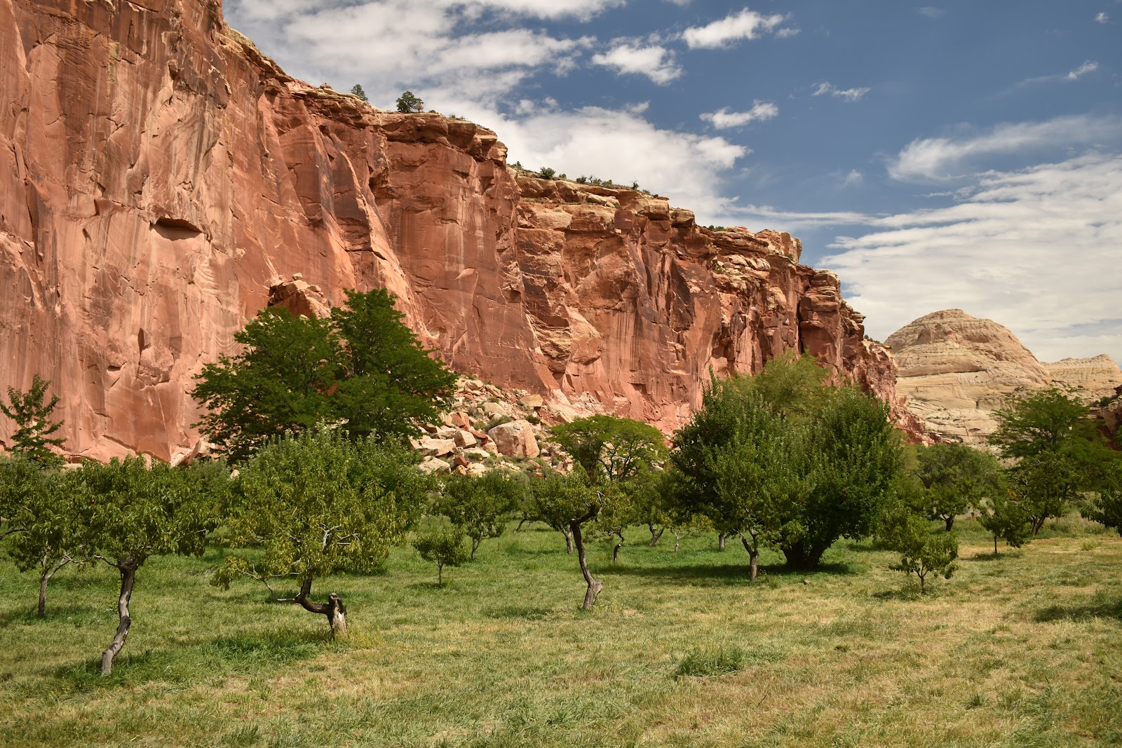
Another of the unique features of this park is that the visitor's center and campground are in the original homesteading village of Fruita. A homesteader moved to this little valley along the river and started planting fruit trees. He then invited his friends and family to join him which they did, planting orchards of primarily apples, peaches, apricots and pears to support themselves. The orchards are small, but well known to the locals (note: in this rather remote area that means anyone within a hundred miles or so) and open to the public so that's a little bonus at this park. U pick fresh fruit. The park has some preserved buildings of historical significance and one had a little bakery that sold the most delicious pies made daily with fruit right from the orchards. It's a good thing there is a limit to the time one can stay in a national park campground or we would have gained ten pounds each!
On to pics!
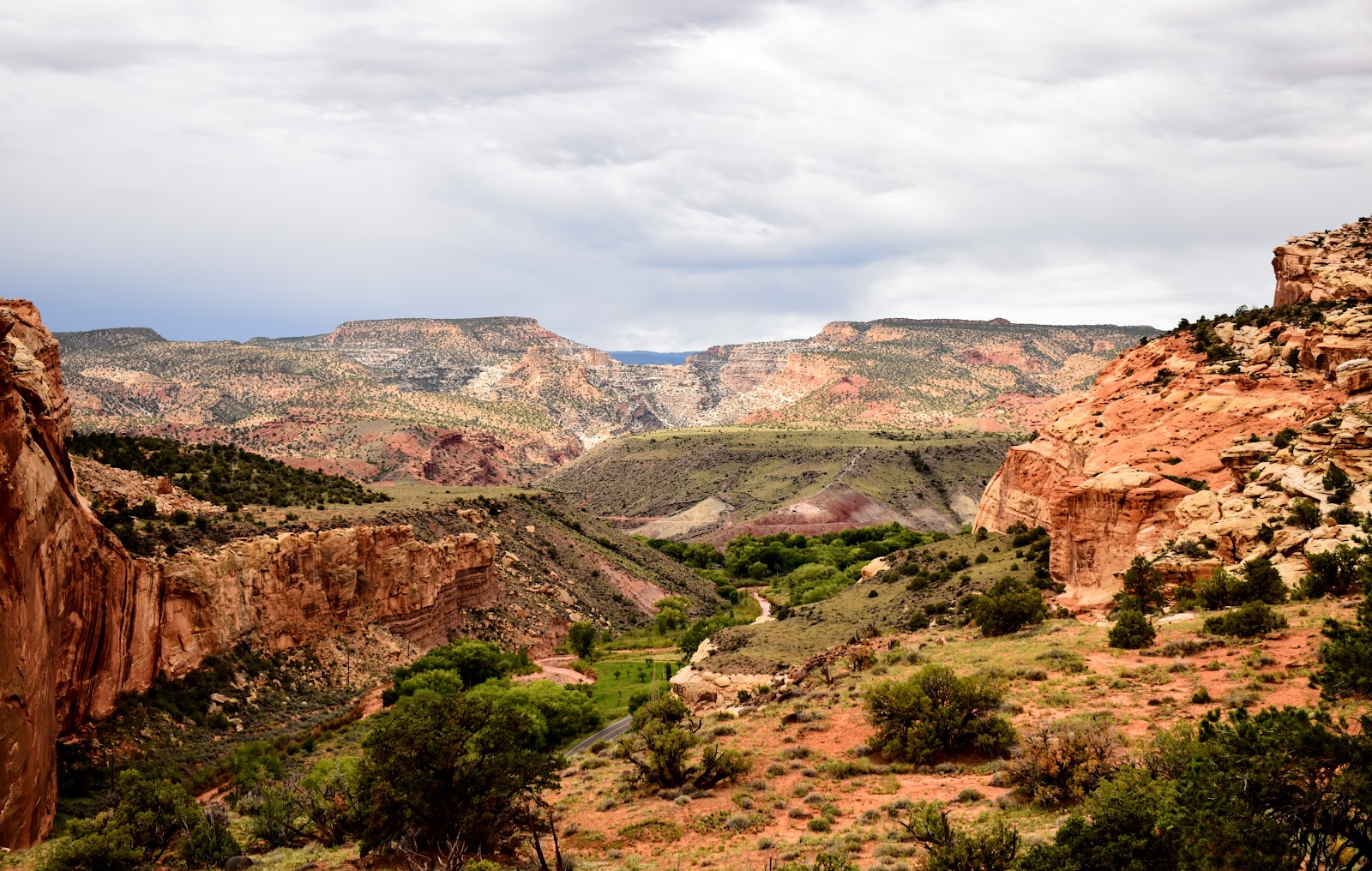
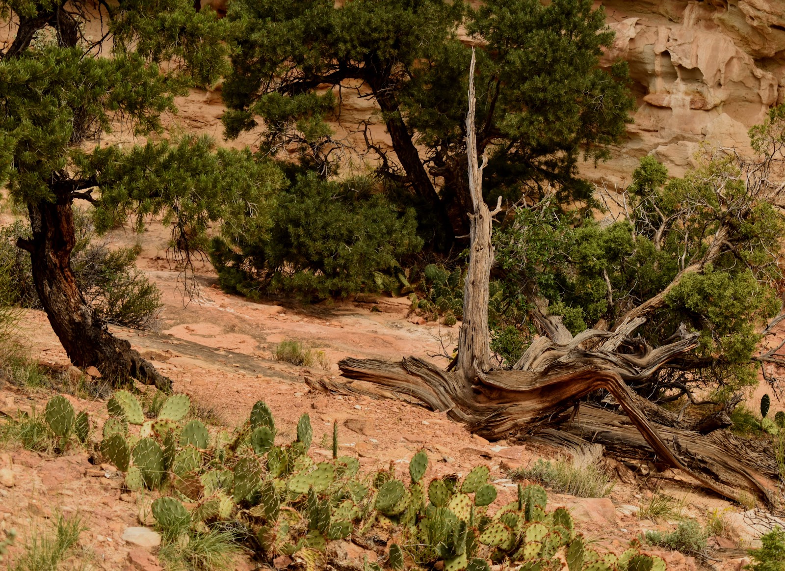
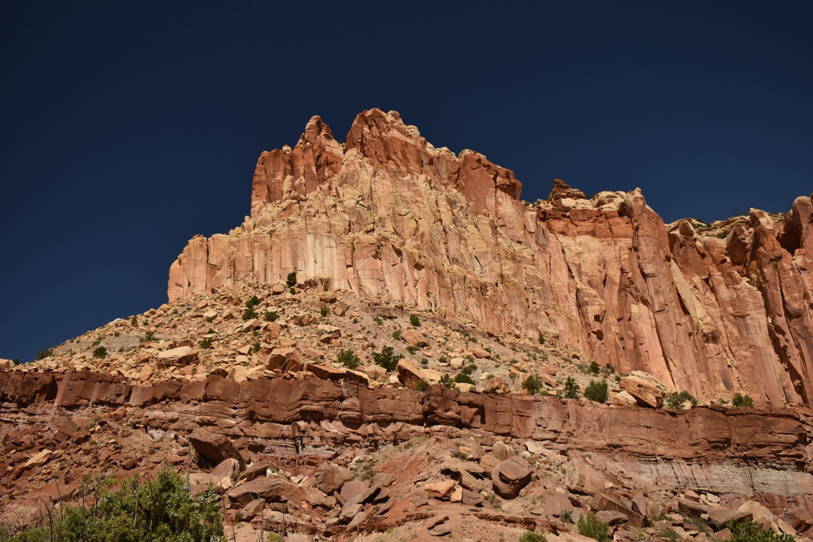
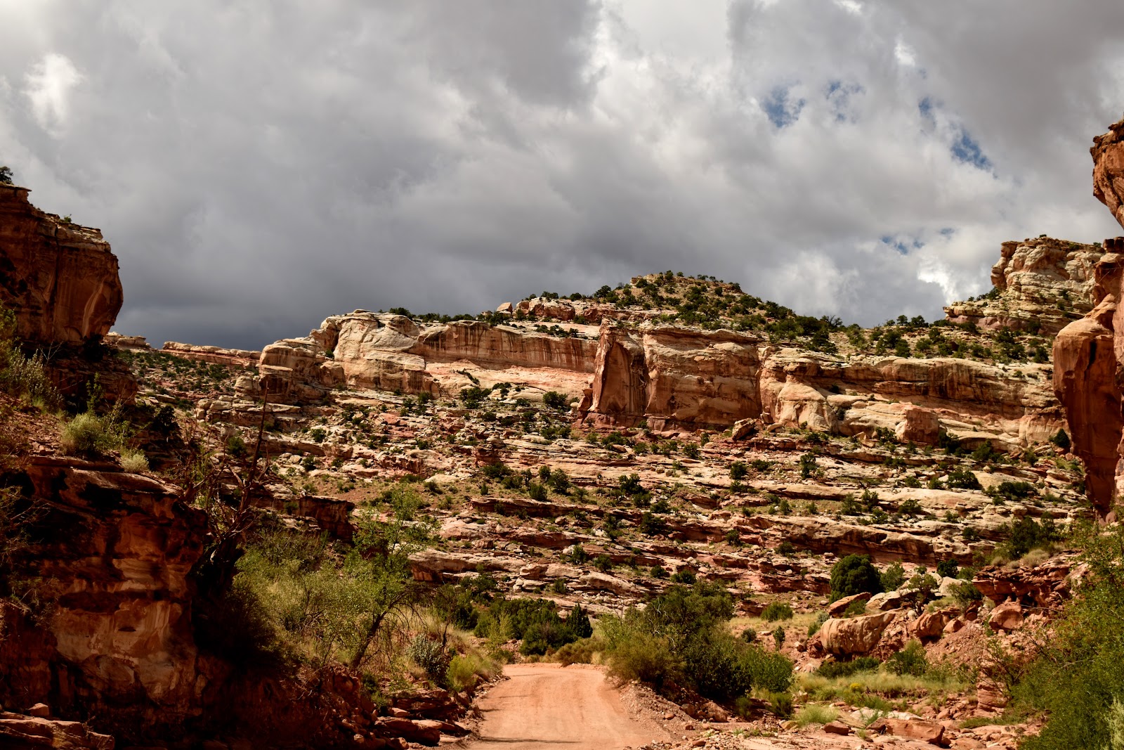
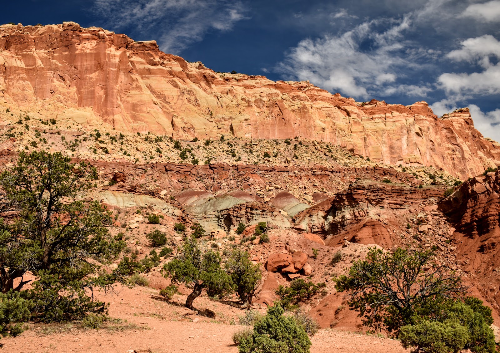
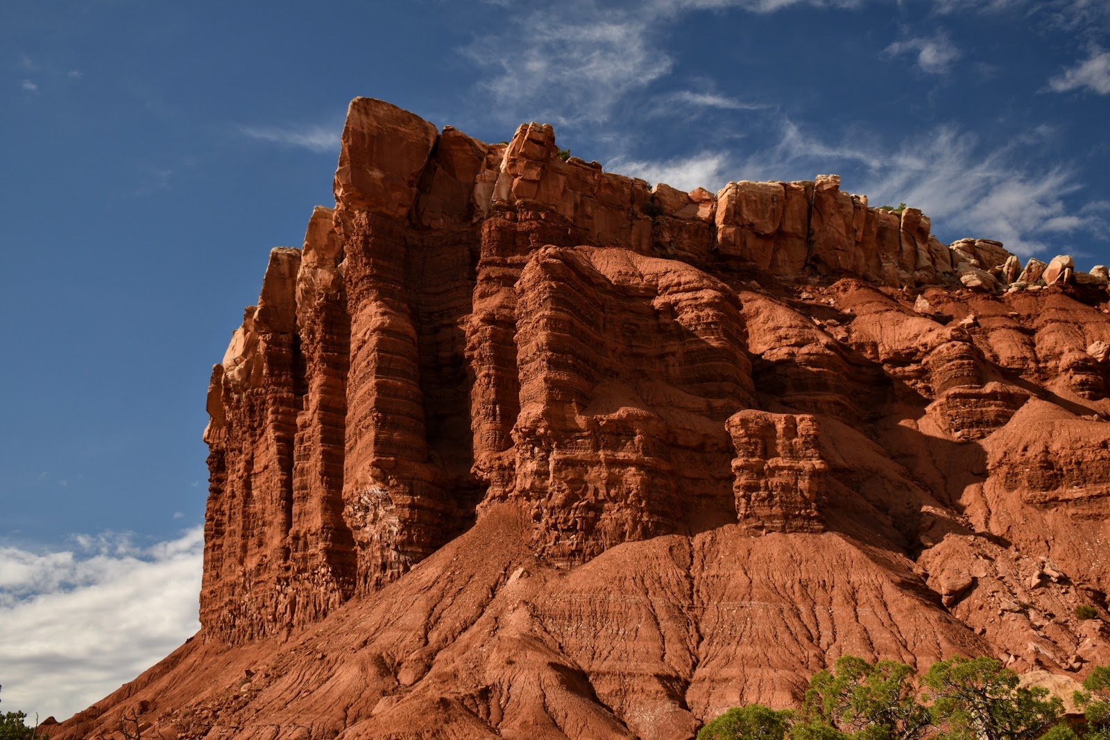
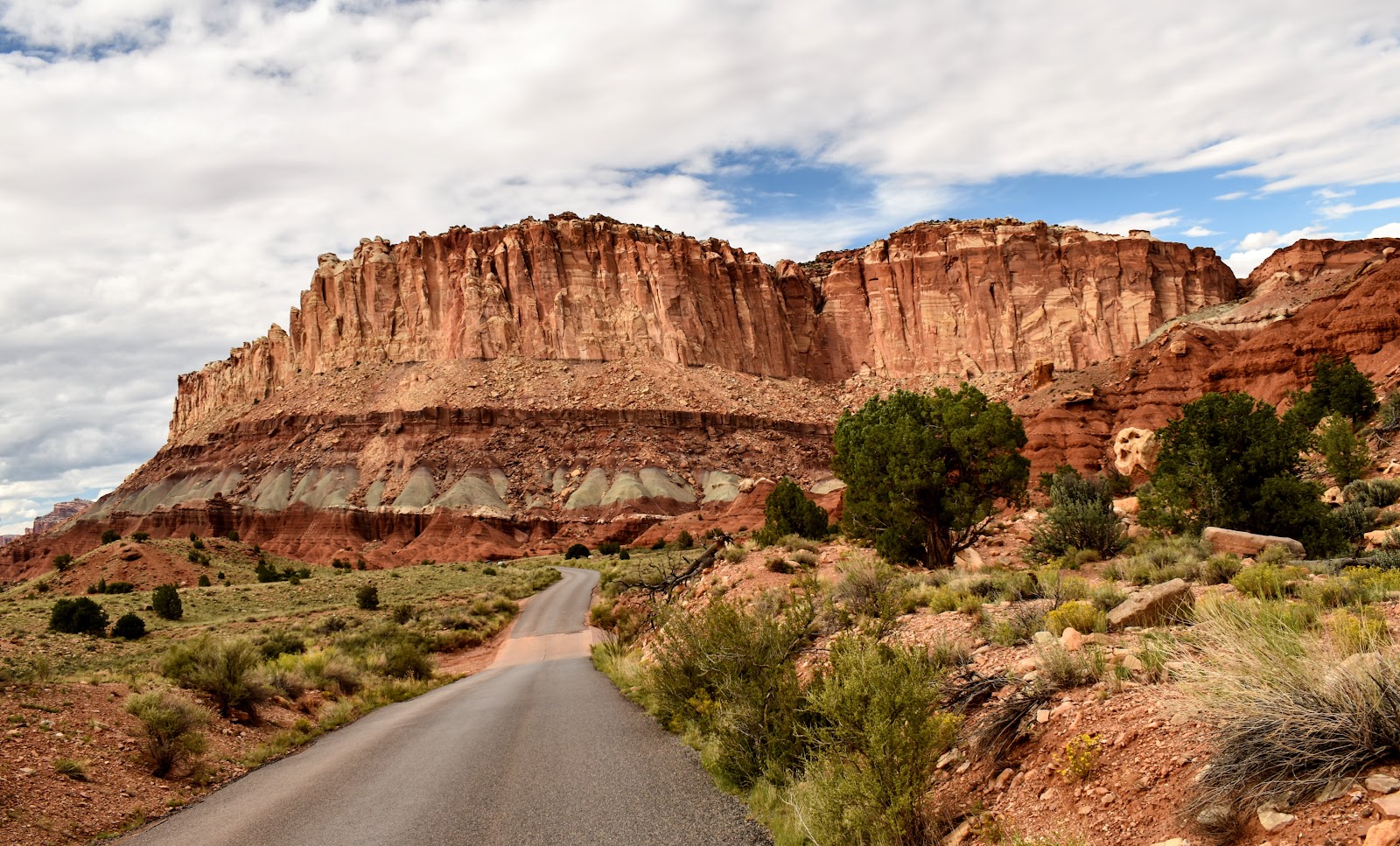
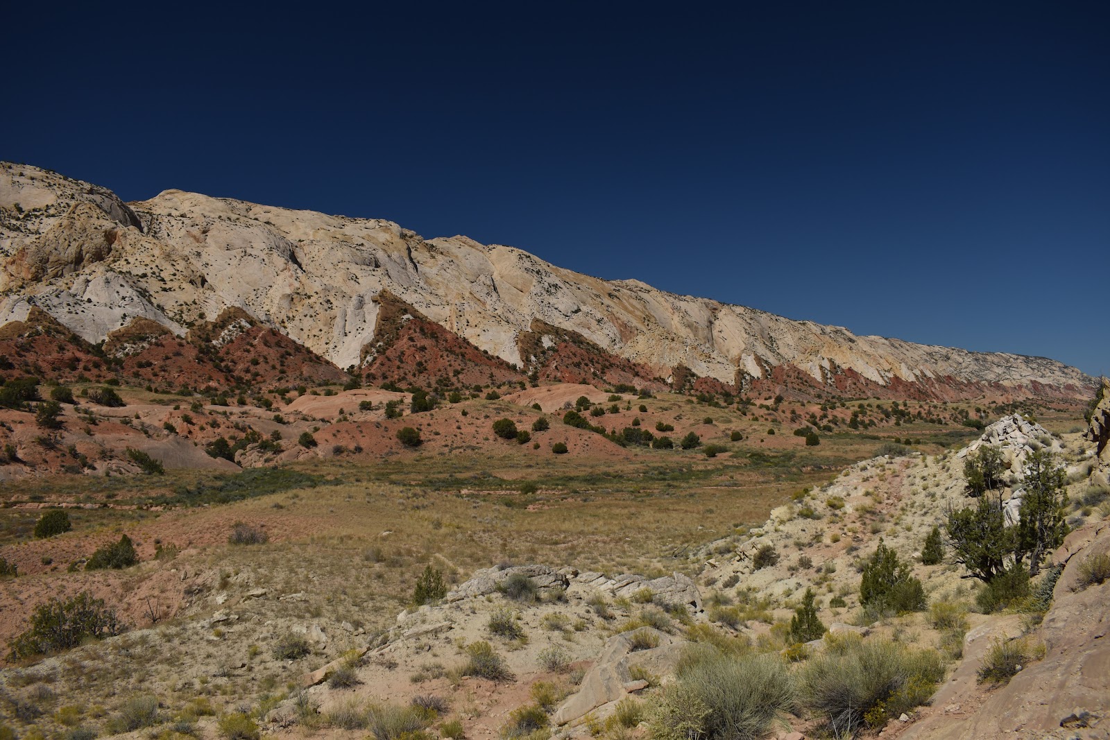
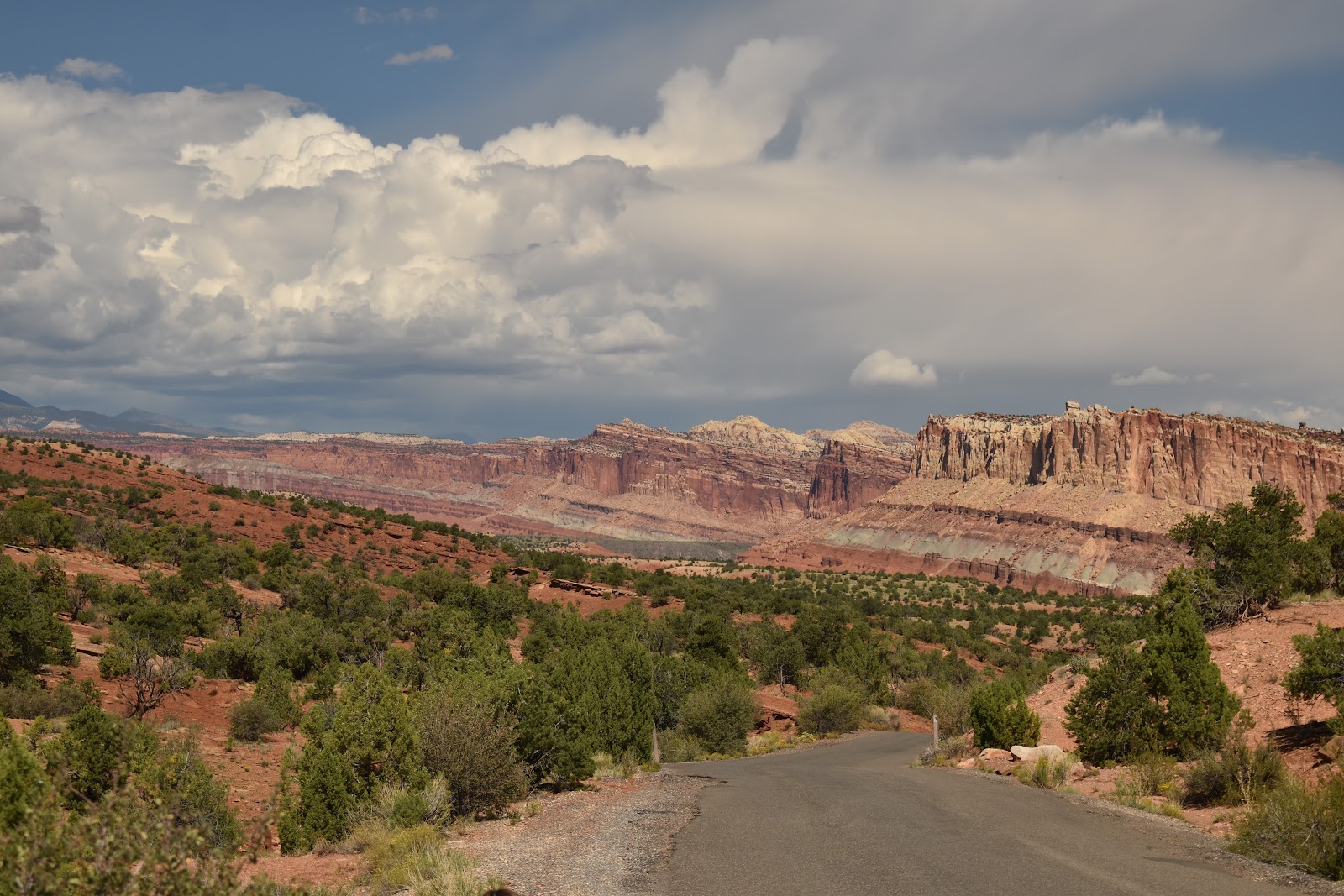
The terrain around Fruita was a sweet, remote, narrow, little valley but … giant cliffs of primarily red rock shot up on the west side with slightly gentler hills quickly turning into giant cliffs on the eastern side, depending upon where you were in relation to the fold.
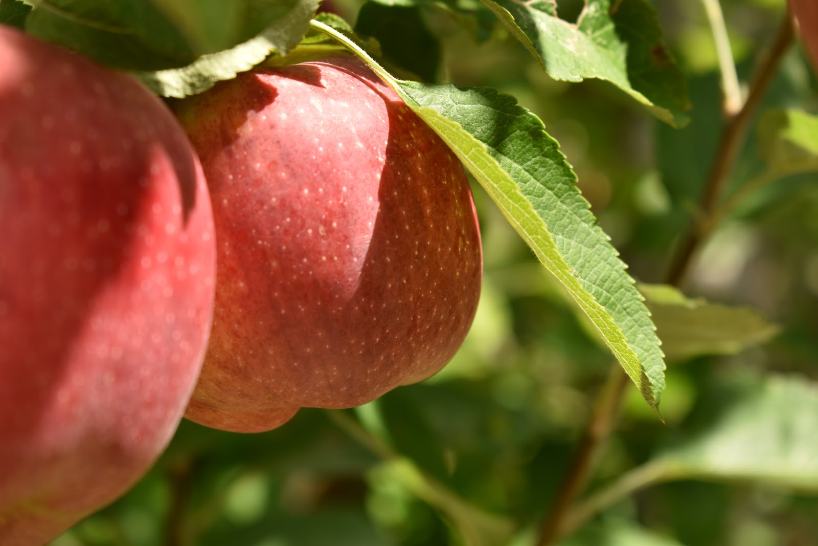
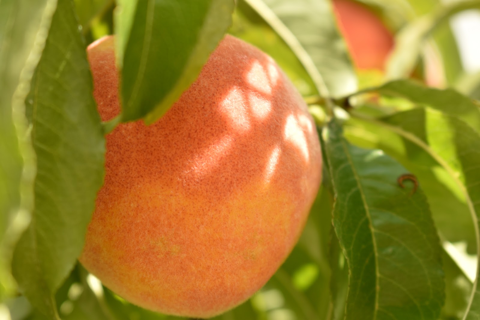
Orchards
The next few pics are of the orchards.
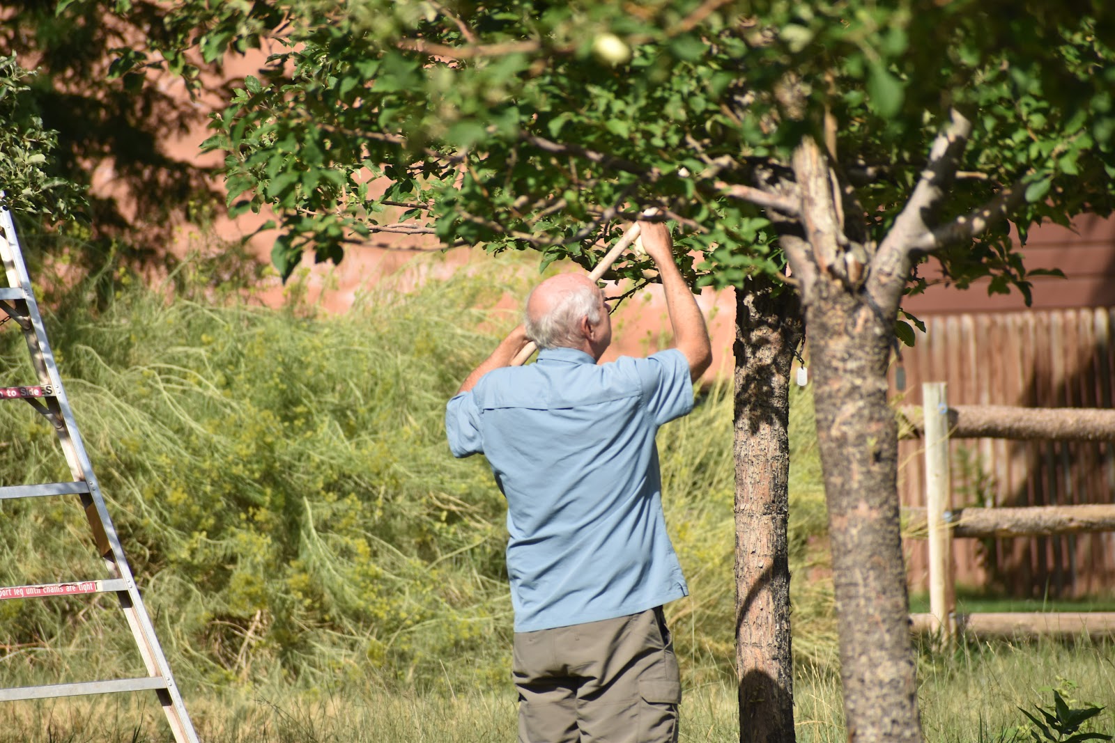
Martin, using the “grabber” to pick the fruit.
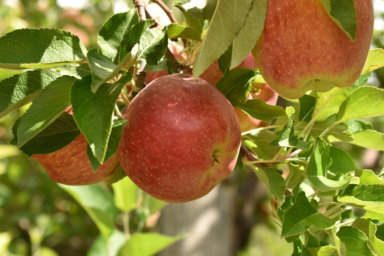
Apples
Peaches
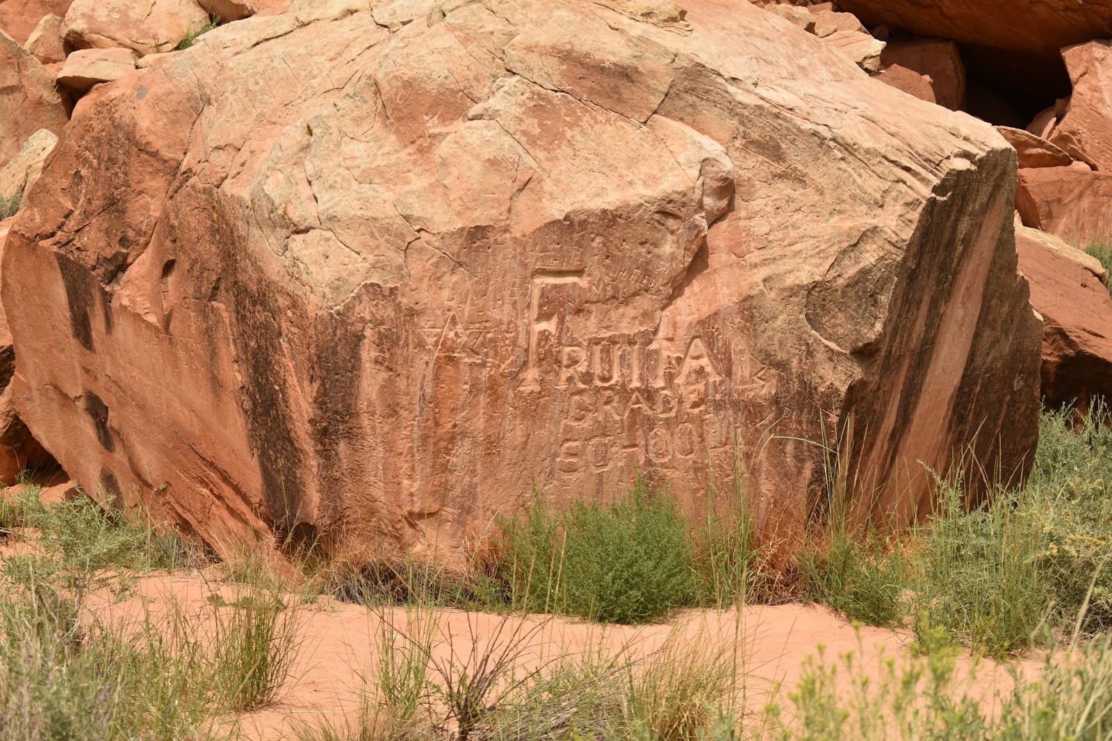
The town marker was, of course, carved in rock and was just behind the school house.
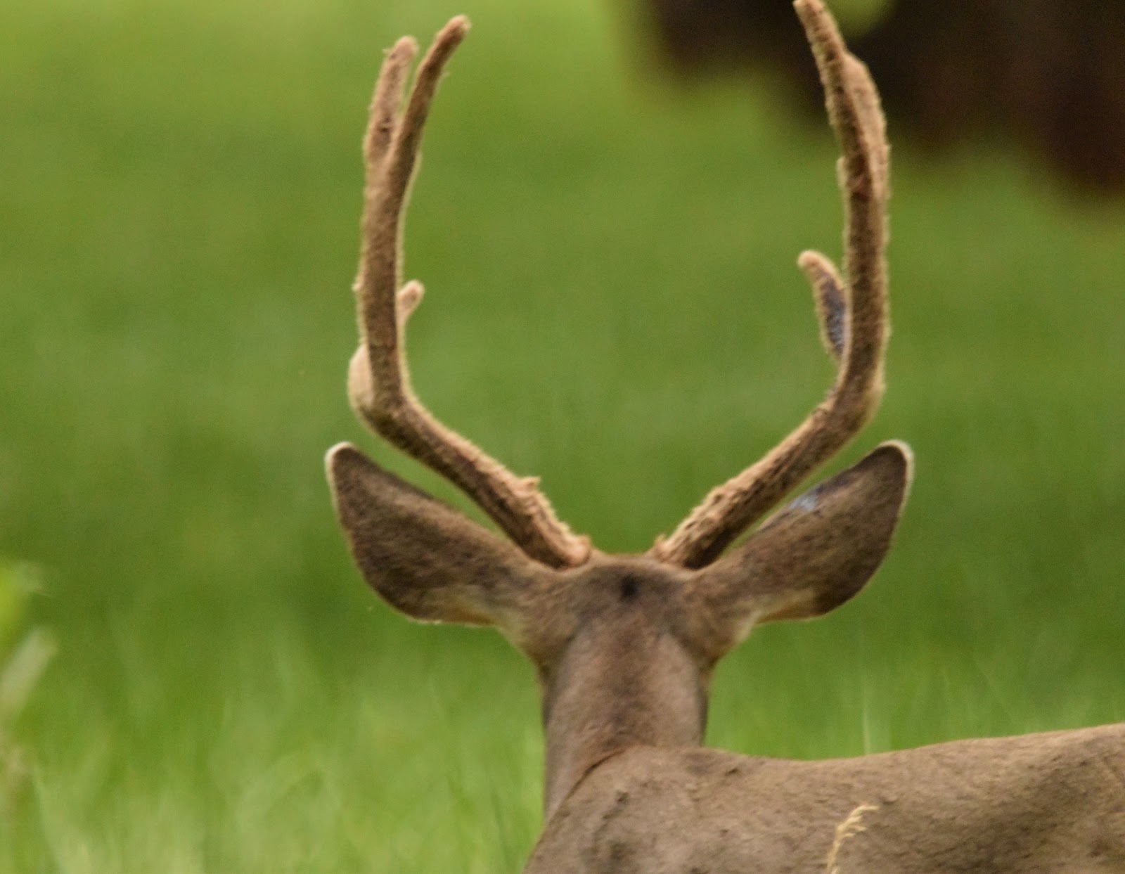
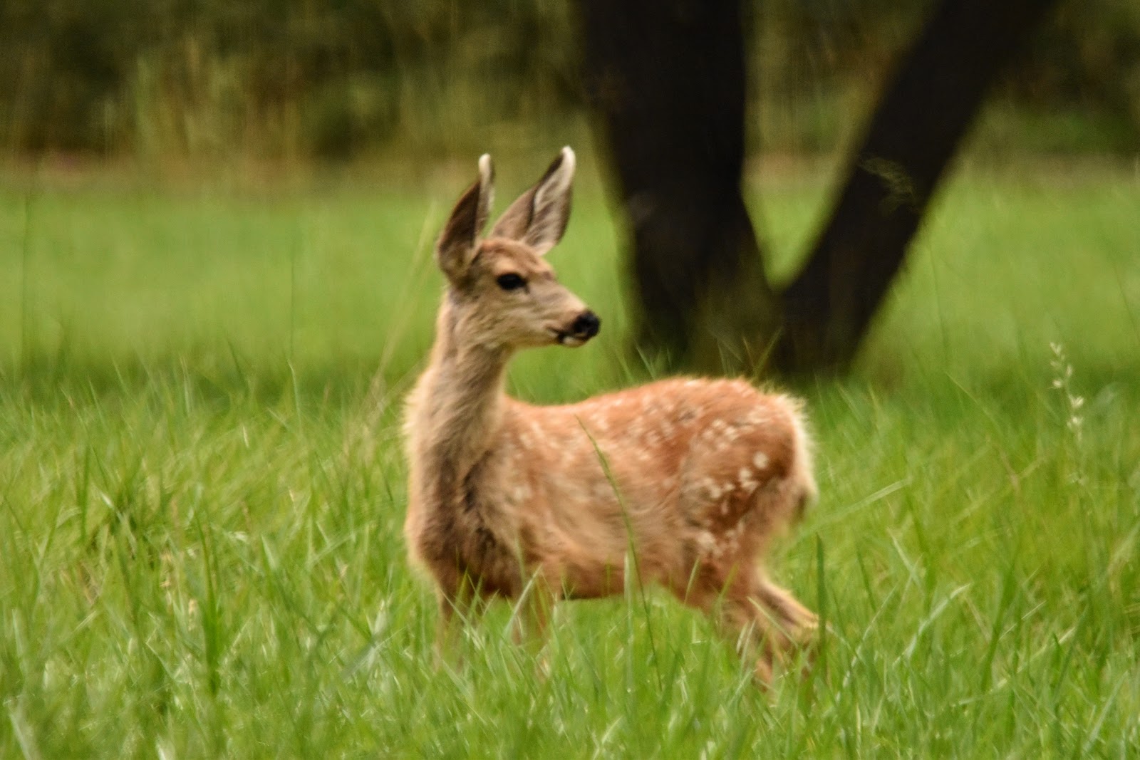
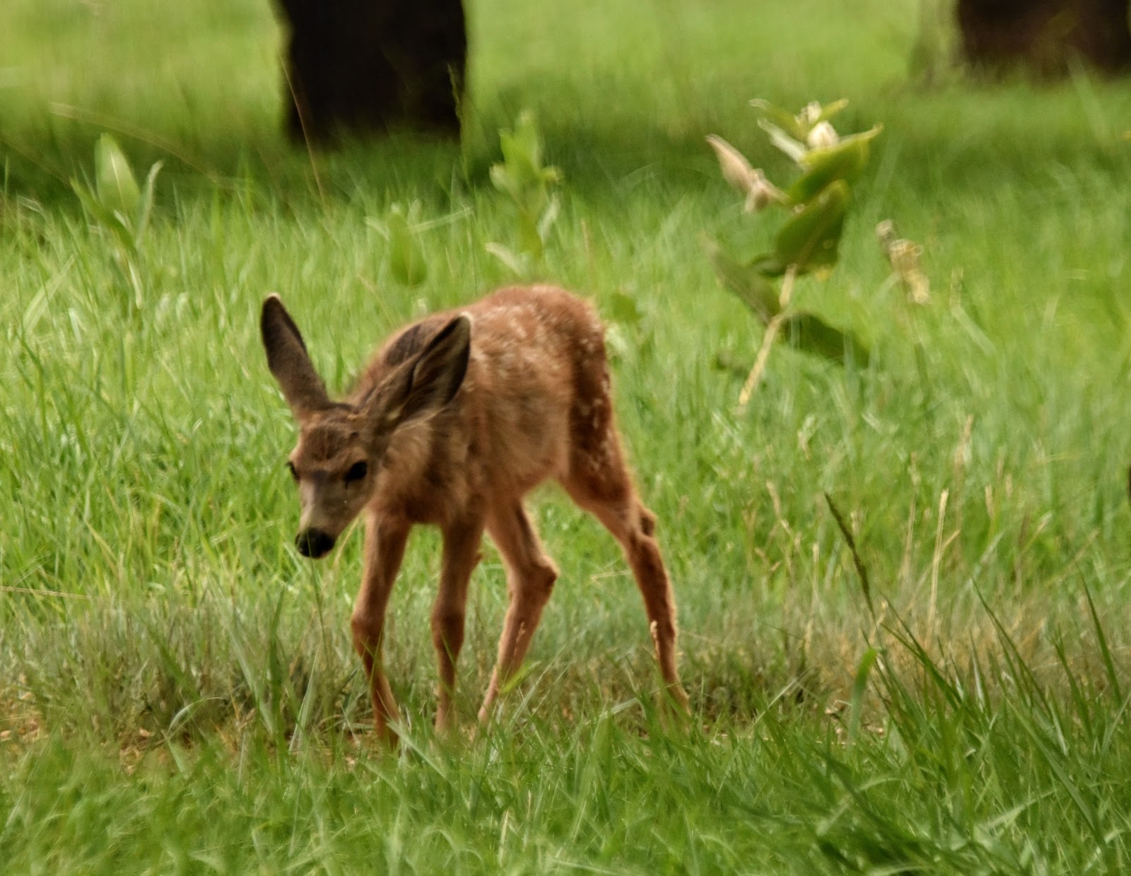
We weren't the only ones who enjoyed the orchards. There were a couple of groups of deer that enjoyed the shade and food that was so plentiful in the trees of the orchards. One group had about 8-10 deer and two sweet little fawns. The other group was smaller, 3-4, with only one fawn.
I love seeing the velvet covered antlers.
On patrol, checking for danger while his herd meanders through the orchard.
The wee ones
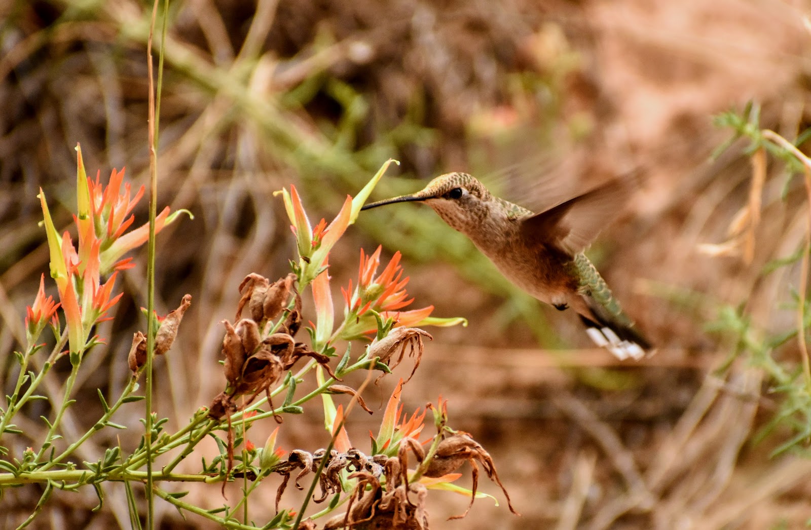
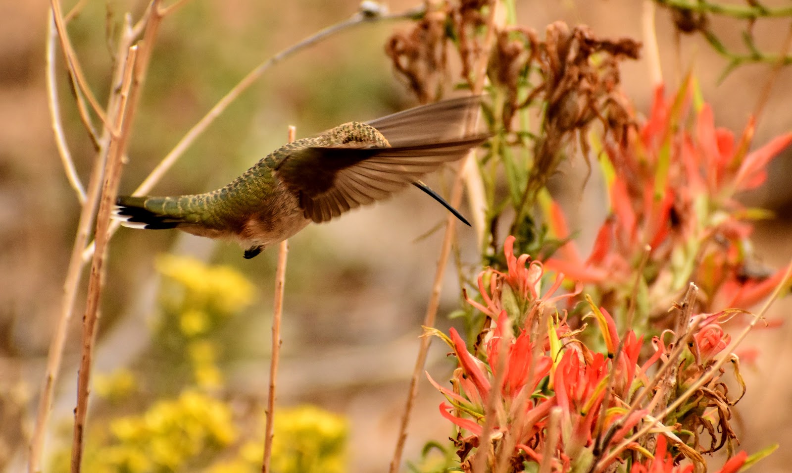
Black-chinned Hummingbird
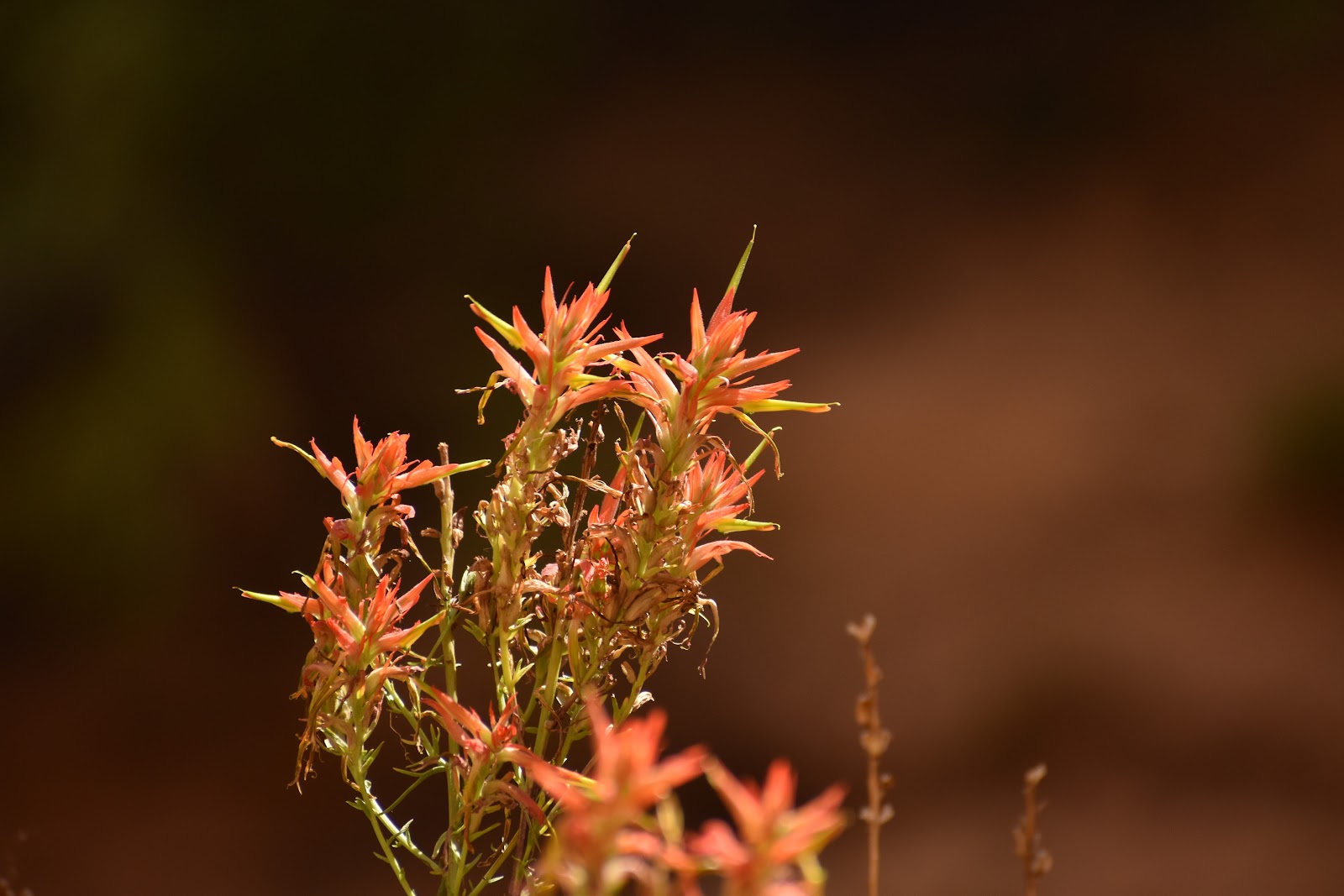
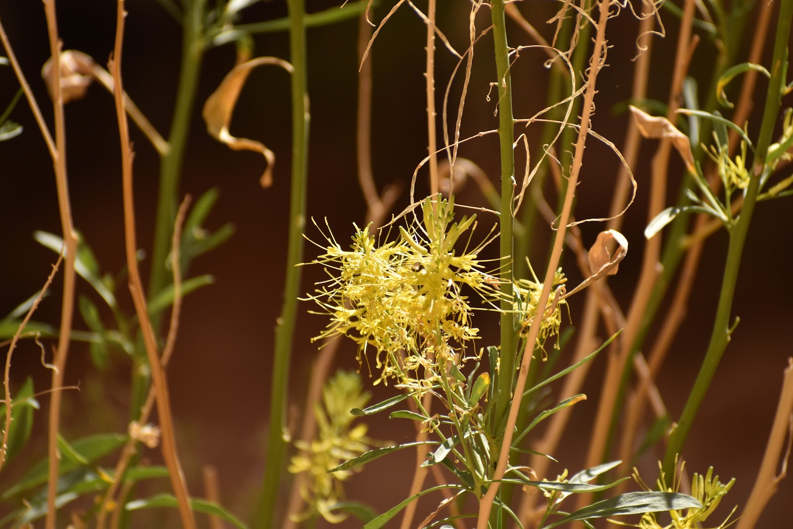
Interestingly, when viewing the paintbrush plant, I had always thought the red parts were the flowers, but the red parts are actually bracts, colored leaves, like what poinsettias have. It's the green that shoots up from the middle of the red bracts that's the real flower. Clearly the hummingbird wasn't confused!
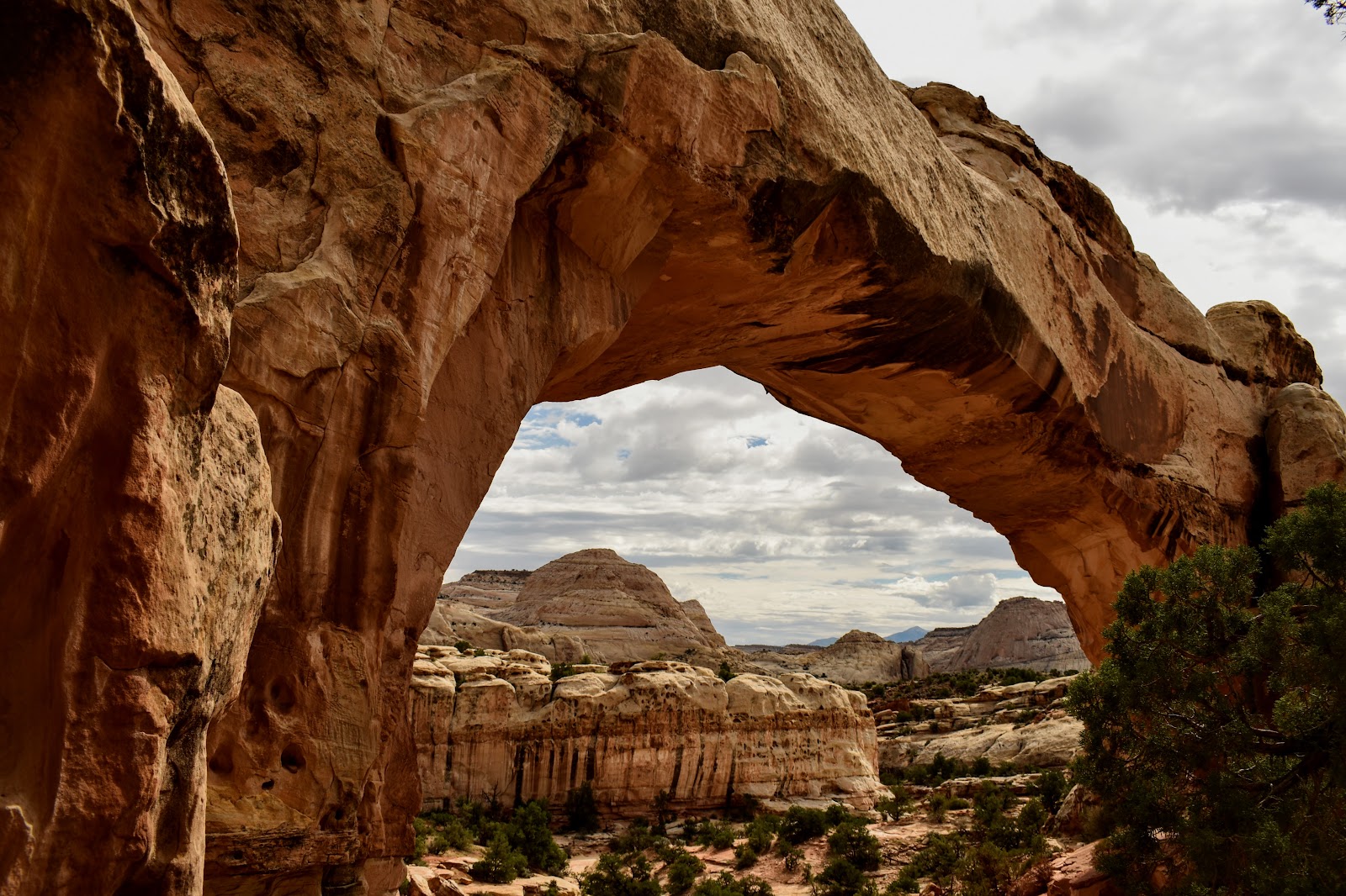
Hickman Bridge. One day we hiked out to see this natural bridge.
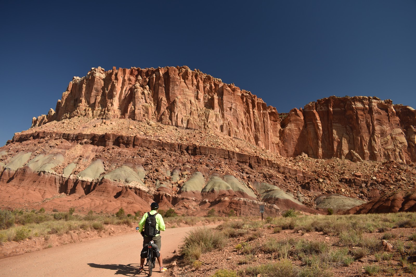
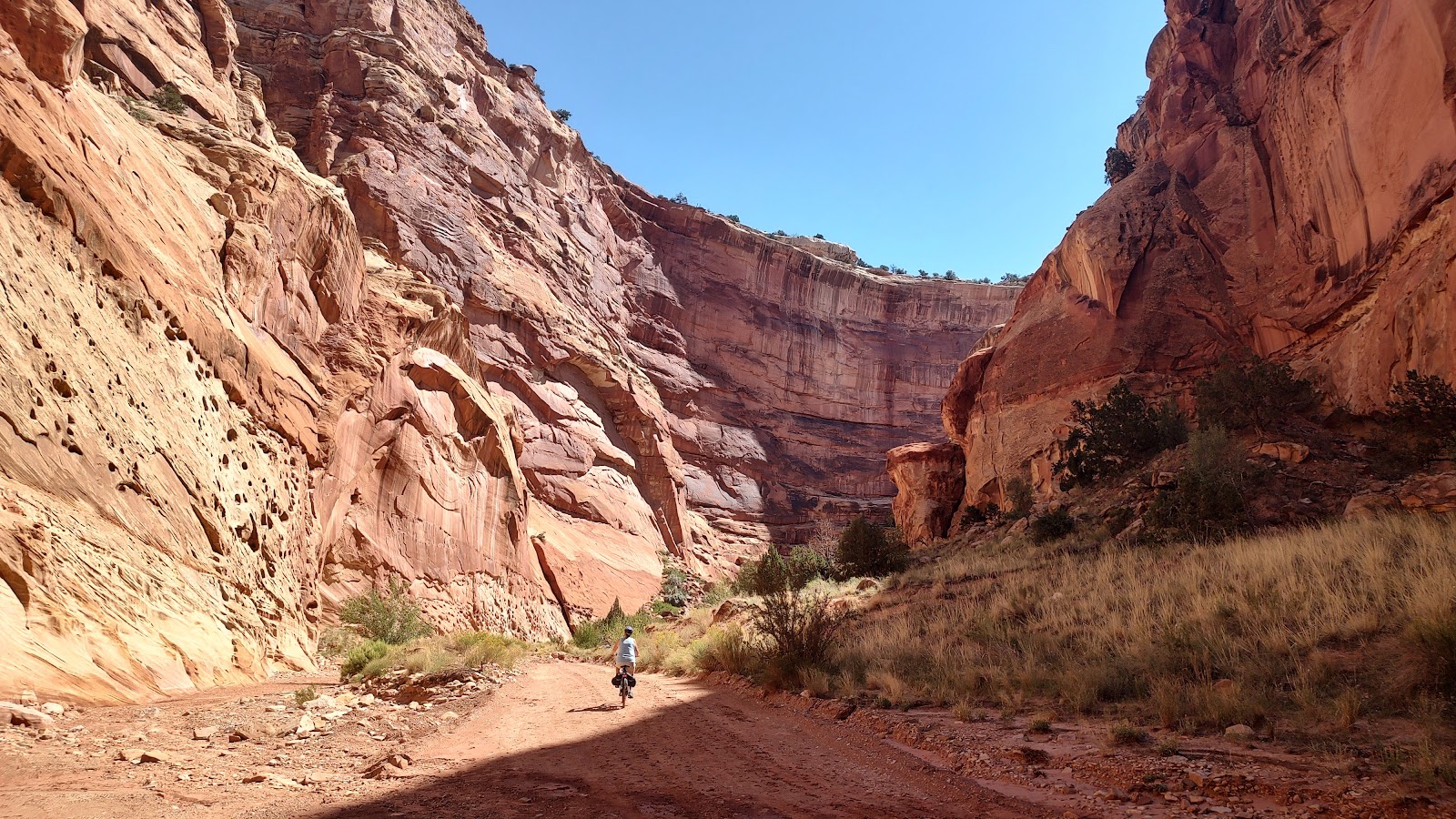
Just past the campground, the road continued into the “scenic drive”. It went about 10 miles into the park. We decided that this would be a great biking opportunity and planned a couple of detours down some side roads to “explore” even more. Overall it was about 25 -30 miles and turned into a bit more of an adventure than we had expected. 😬
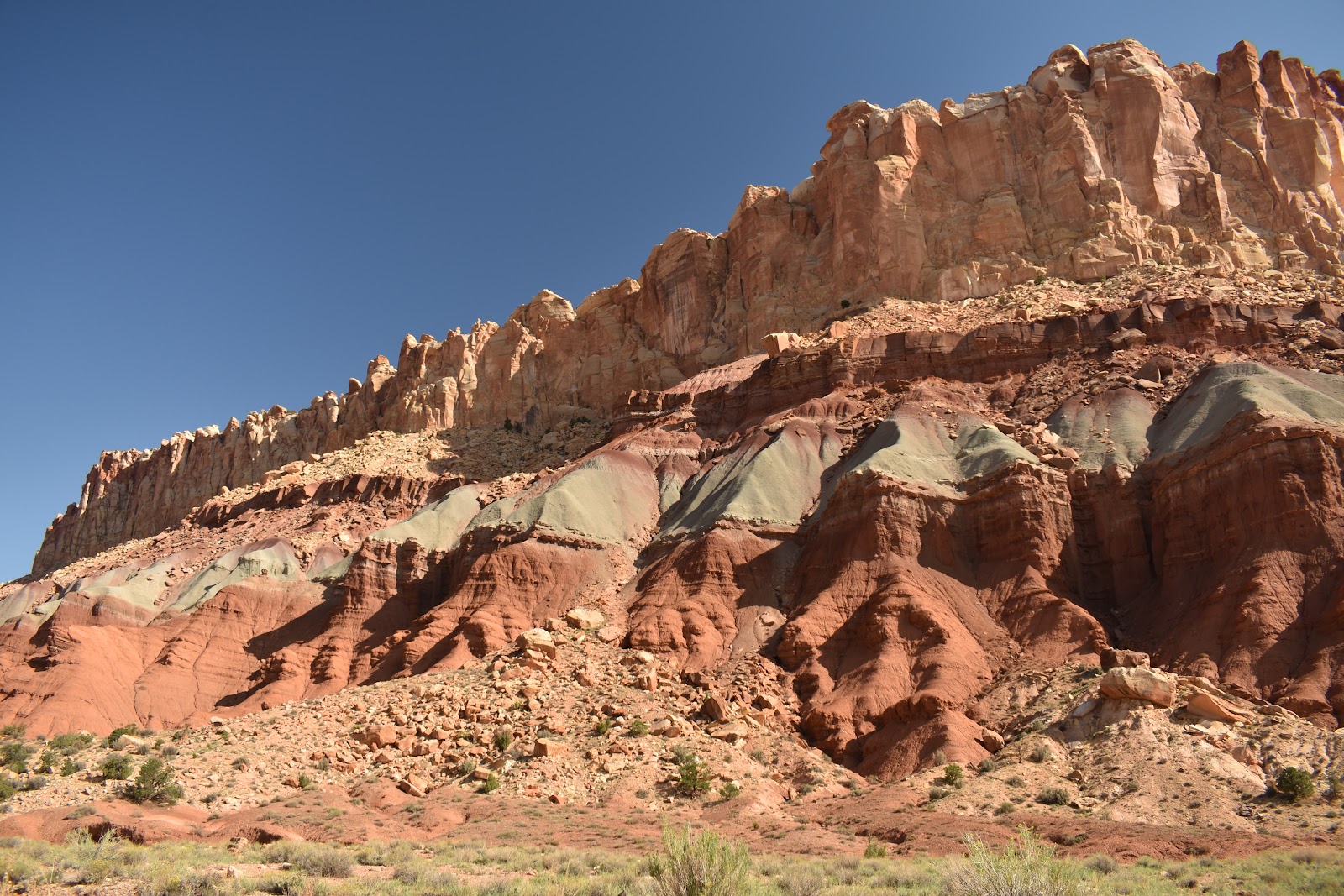
The cliffs rock faces are just beautiful with the color banding and interesting shapes.
Martin on his bike. This was out first detour. A uranium mine was about a mile down this road. Although this area had lots of relatively easily mined uranium, the mines were not very profitable due to the inaccessibility of their location in "the fold" which made transportation of the mined ore prohibitively expensive.
At the end of the scenic drive was another dirt road, well actually it quickly turned into a wash that we followed for several miles.
The farther we rode our bikes down this wash, the closer the sides of the canyon came. And for perspective, that little thing just past the shade line in the bottom center is me on my bike. Haha!
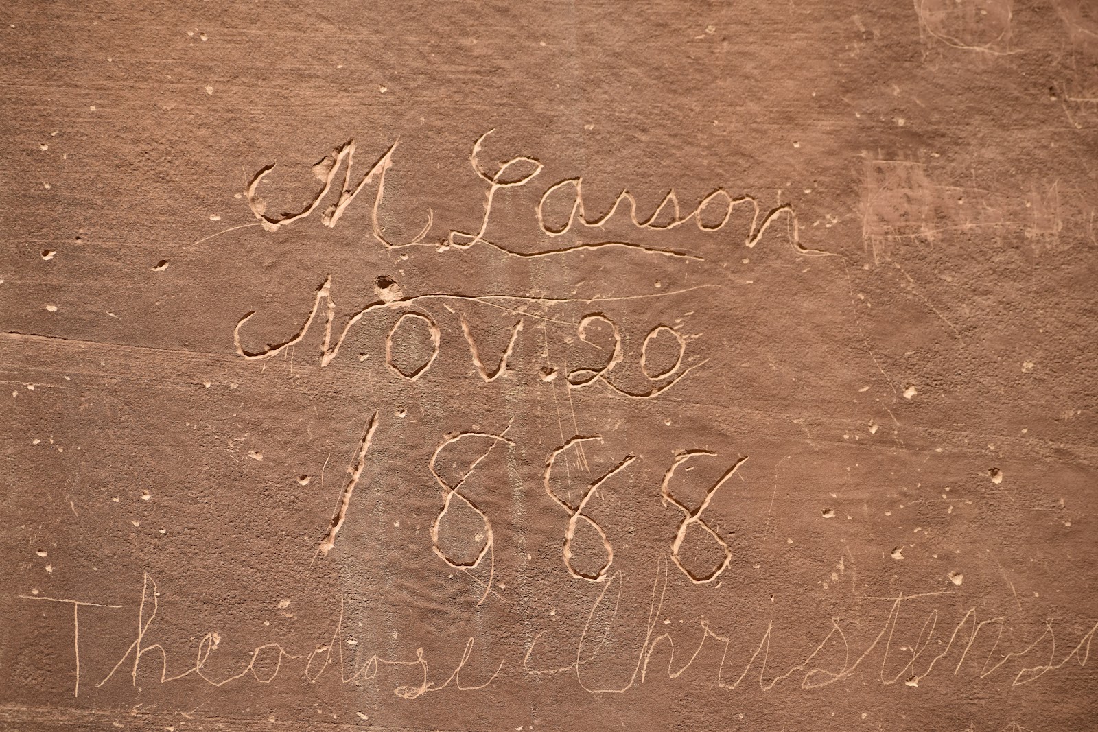
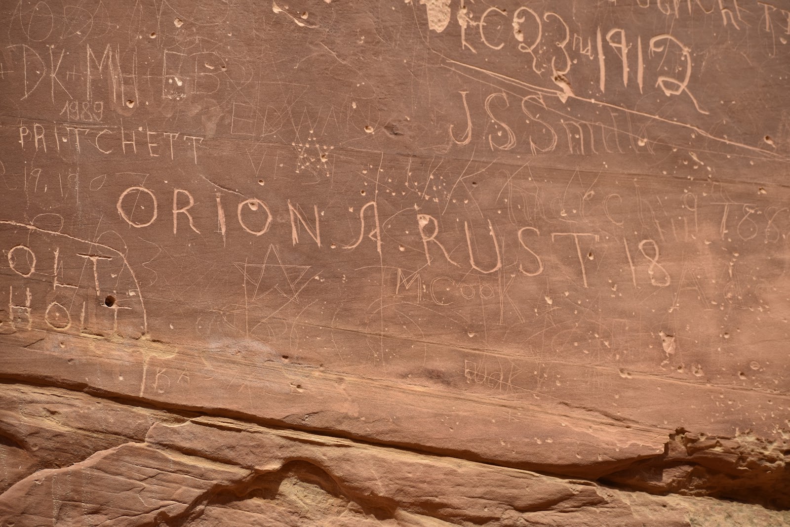
We eventually arrived at pioneer register. A section of wall so smooth and close to the trail that people used this spot to mark their passage by recording their names and dates of travel on the wall.
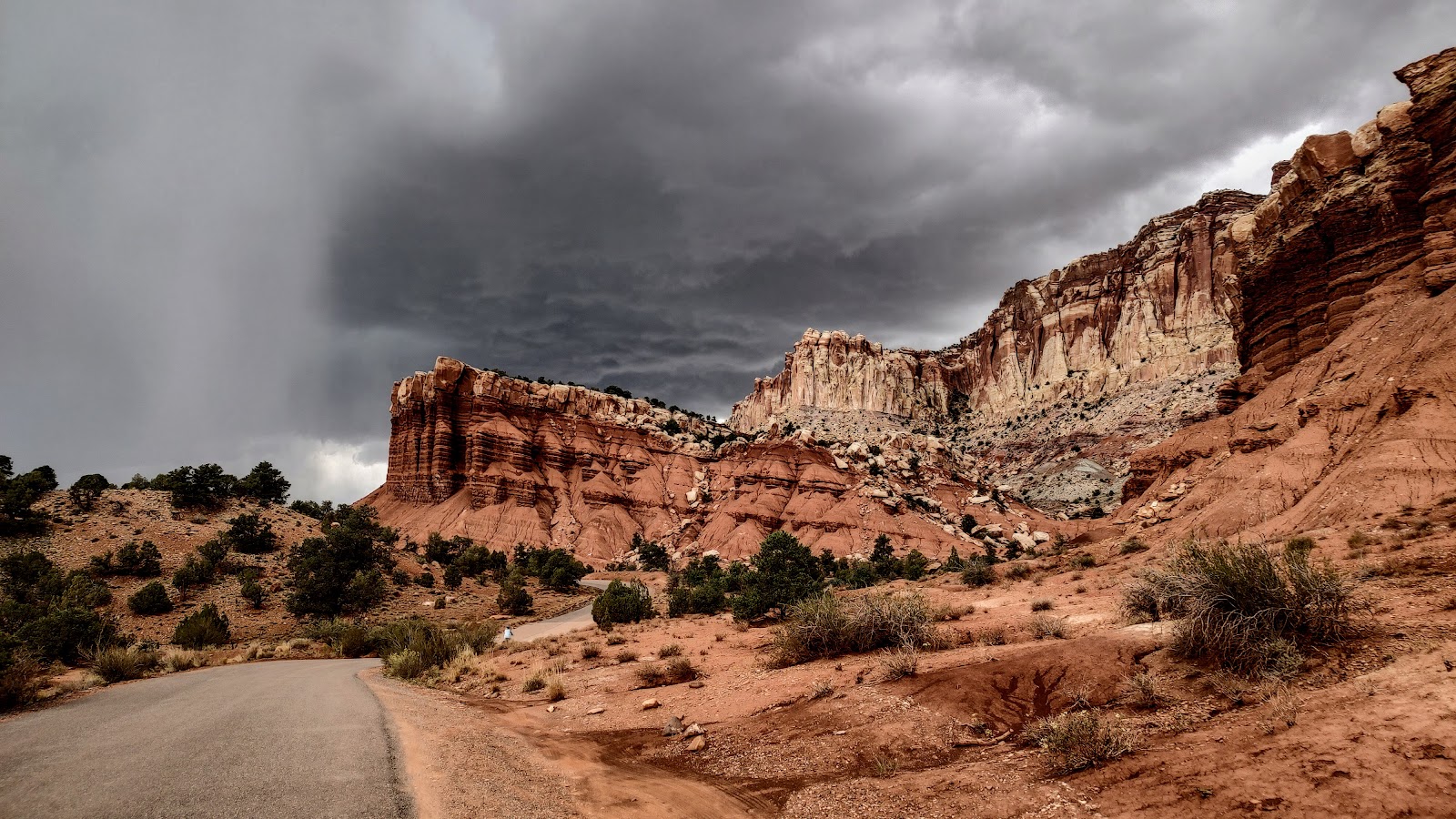
Aftrr viewing the wall, we decided to turn around and head back. Rain had been forecasted for about 4:00 and the rangers at Capitol Reef were very strict about heeding the potential flash flooding and closing roads. So, back we went. As the tall, canyon walls opened up a bit, we noticed that our sunny day had disappeared and it looked like a storm might be coming in a few hours earlier than expected.
We were far from “home”, and unfortunately headed straight into the storm. This is a very remote park. There are a few spots one could find shelter along the exterior, but really nothing in the interior of the park. (You know, the whole fold thing.) So all we could do was bike, as fast as our little legs could take us, back to Myrtle in the campground.
This was the high elevation point. We caught our breath, donned our rain coats and got ready to try and race the storm the rest of the way back.
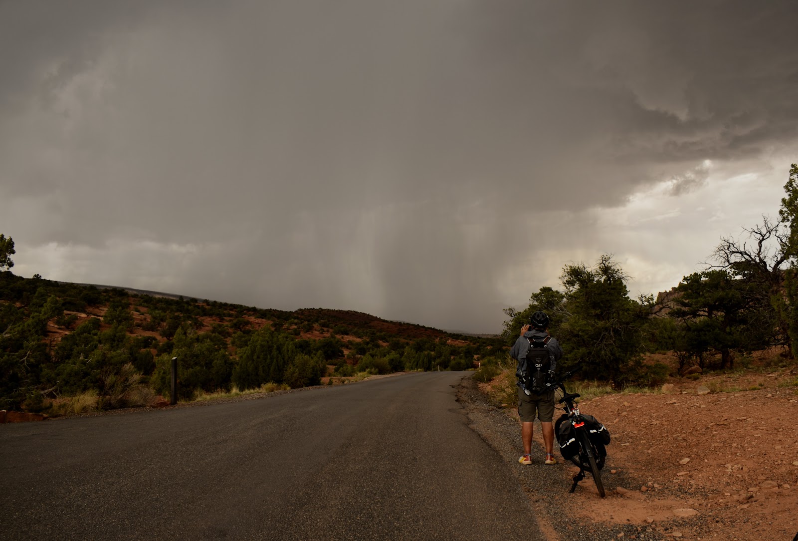
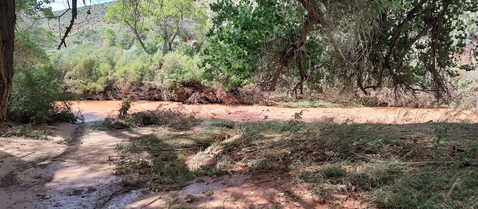
Almost immediately after we started from this spot the rain let loose. And shortly after the rain started … lightening, thunder, wind AND hail! Whatever was coming out of the sky, rain, hail, a combination of the two was so intense it actually hurt as it hit our faces and legs. We just kept biking as fast as we physically could. At one point we made it to a spot where water of an “unknown depth” was rushing across the road. We were not alone, a line of ten to fifteen cars, trucks and campers (plus, of course, Martin and I on our little bikes) were stopped, being pummeled by precipitation and wind, wondering if we should cross this fast flowing brown water. Yikes! After a good ten to fifteen minutes of waiting to see what we should do … a brave soul went through it and they seemed fine so gradually everyone went through. I was pretty nervous, but the water was only about 4” deep and although the current was strong, it was no trouble to ride through. By the time we got back the scenic drive was closed (duh) and the ranger had to open the gate to let us out
The aftermath at our campsite. Those are some of our solar panels drowning in a slushy combination of water and hail. Total precipitation at our campsite was 6+” in an hour. And the temp dropped almost 30°. We were soaked and frozen but mostly we were just thankful to have made it back safely!
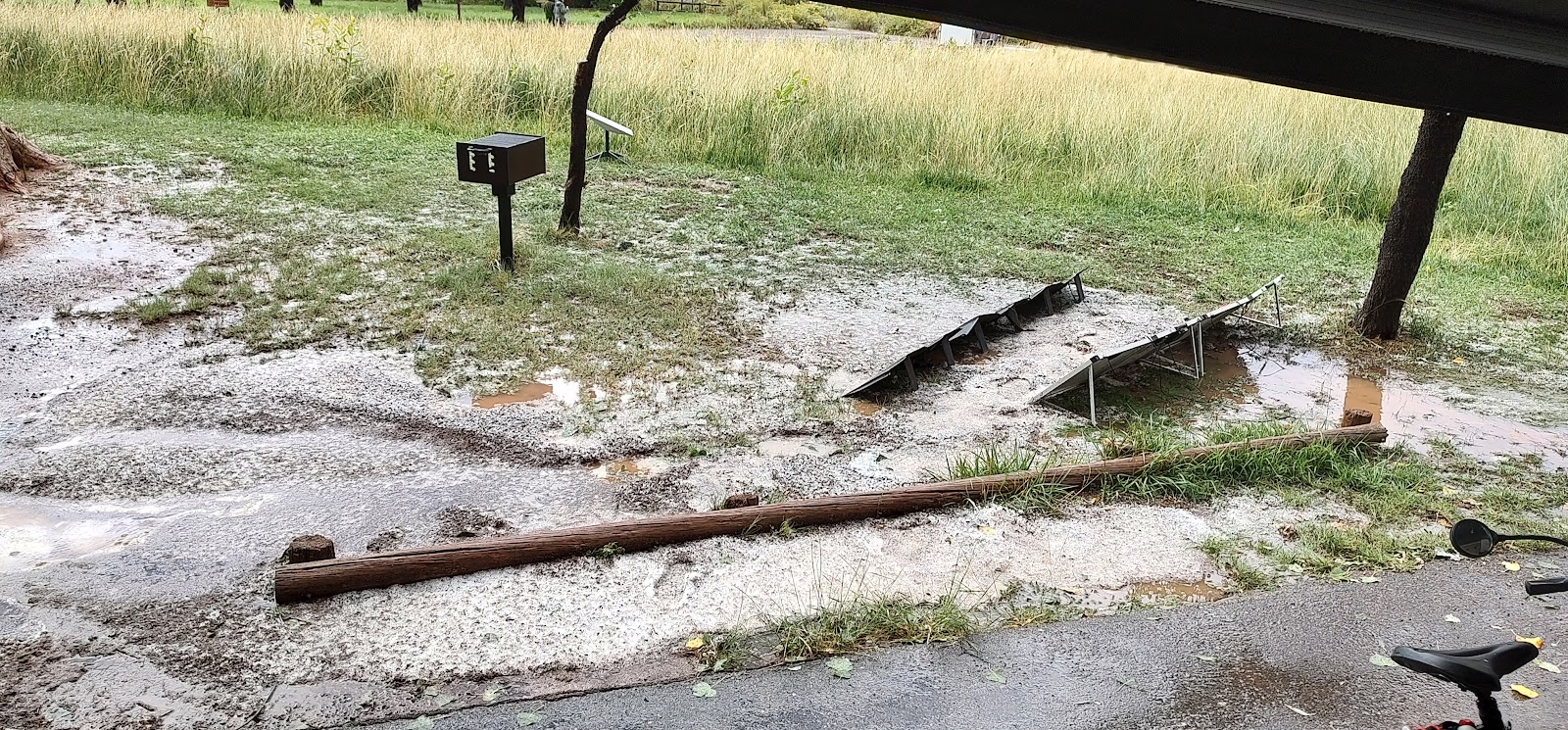
The flooded campground
And the next day … gorgeous again
Back on scenic drive to get some pics we missed the day before ... 🙄
This section of rock was called the Egyptian Temple.
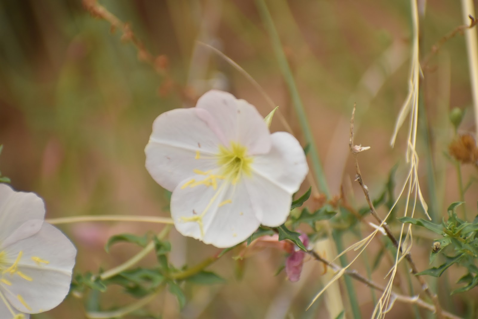
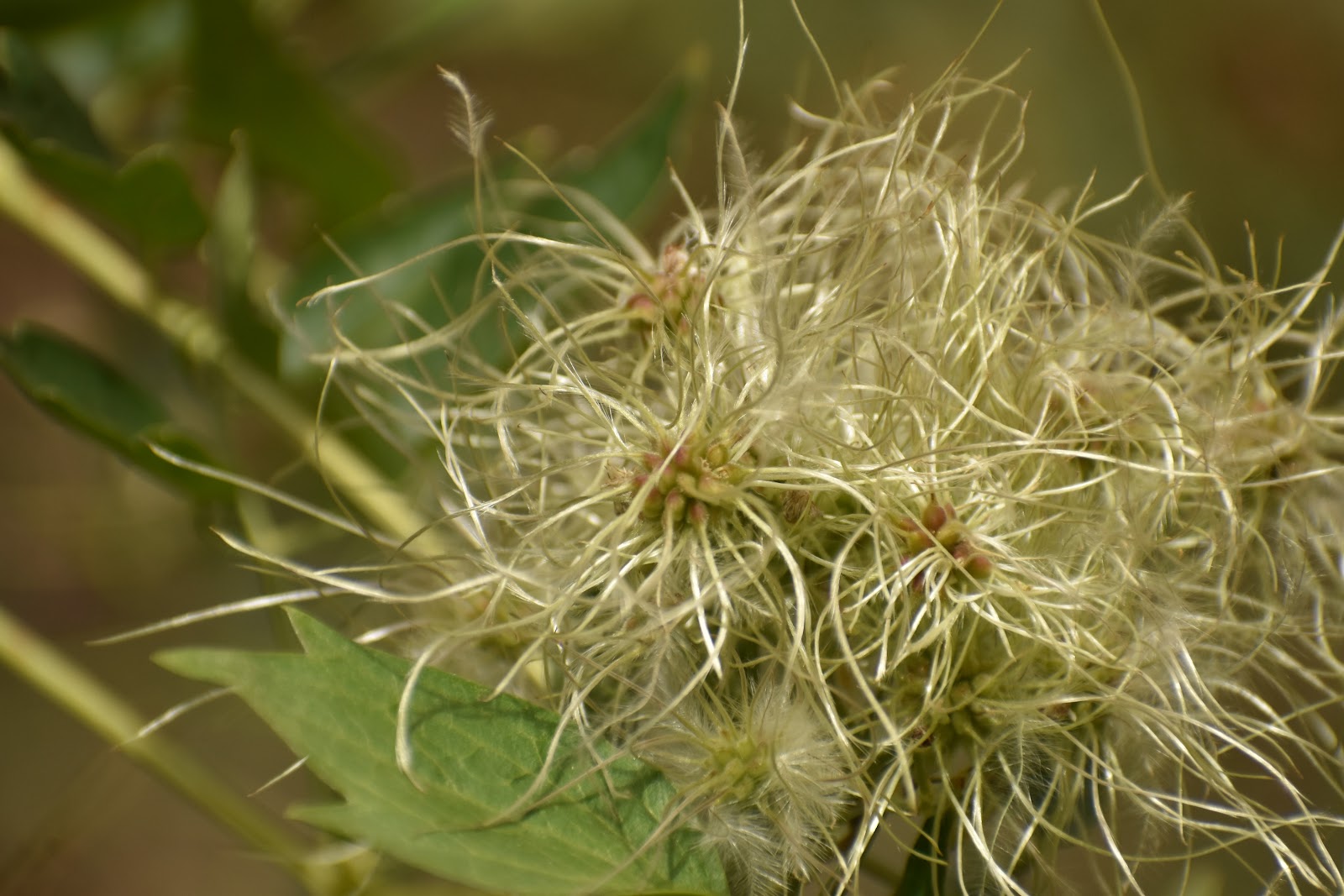
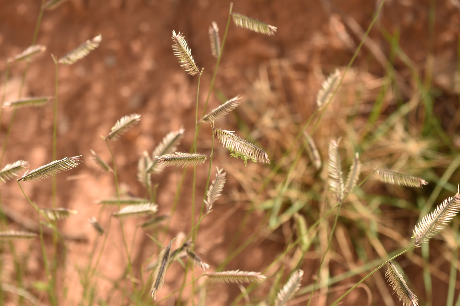
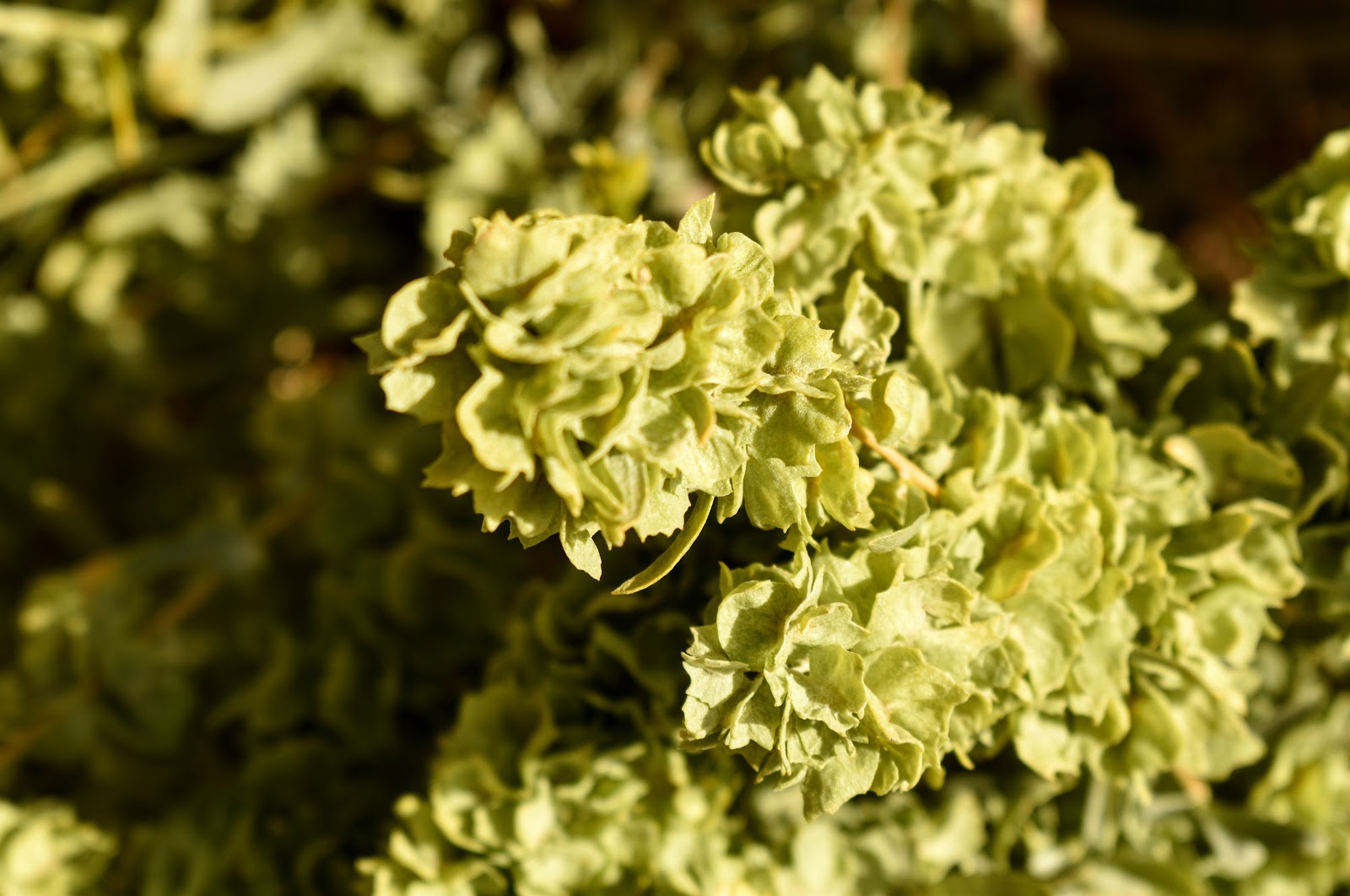
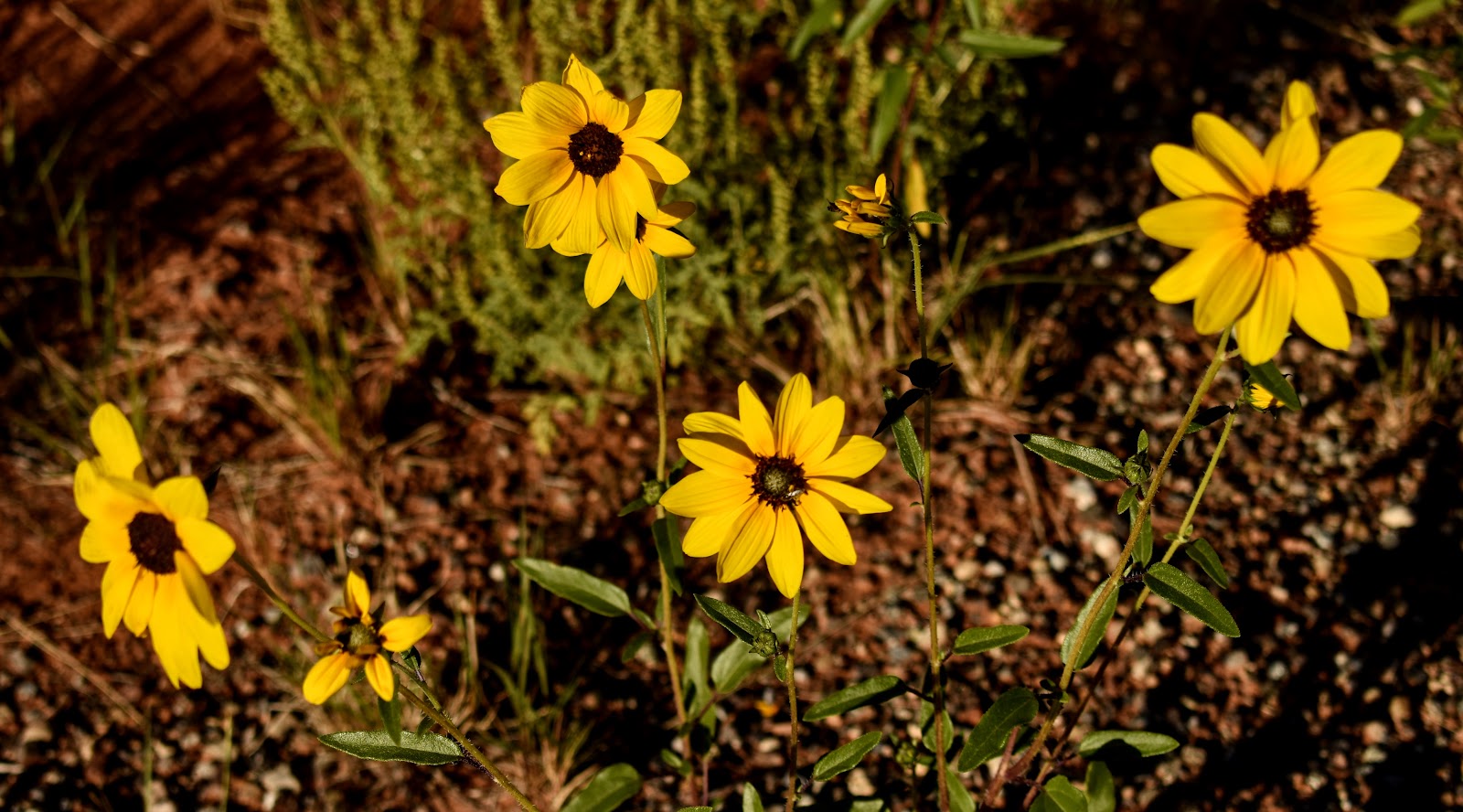
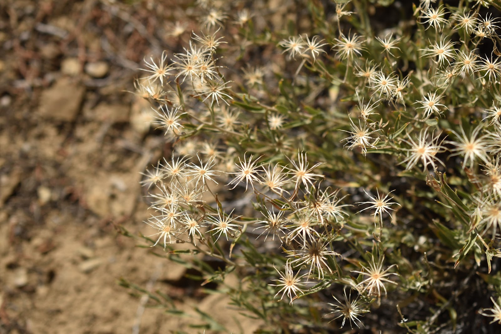
Flora
Pale evening primrose
I like the way the grass heads looked, golden against the red rock.
4 winged salt bush
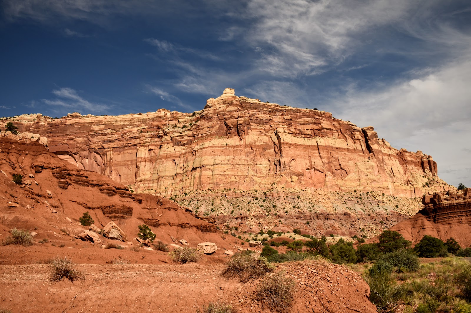
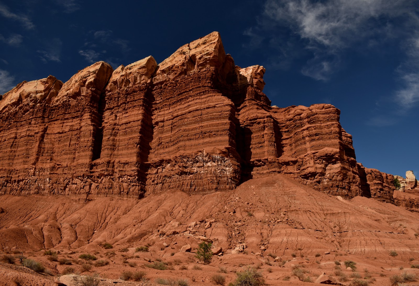
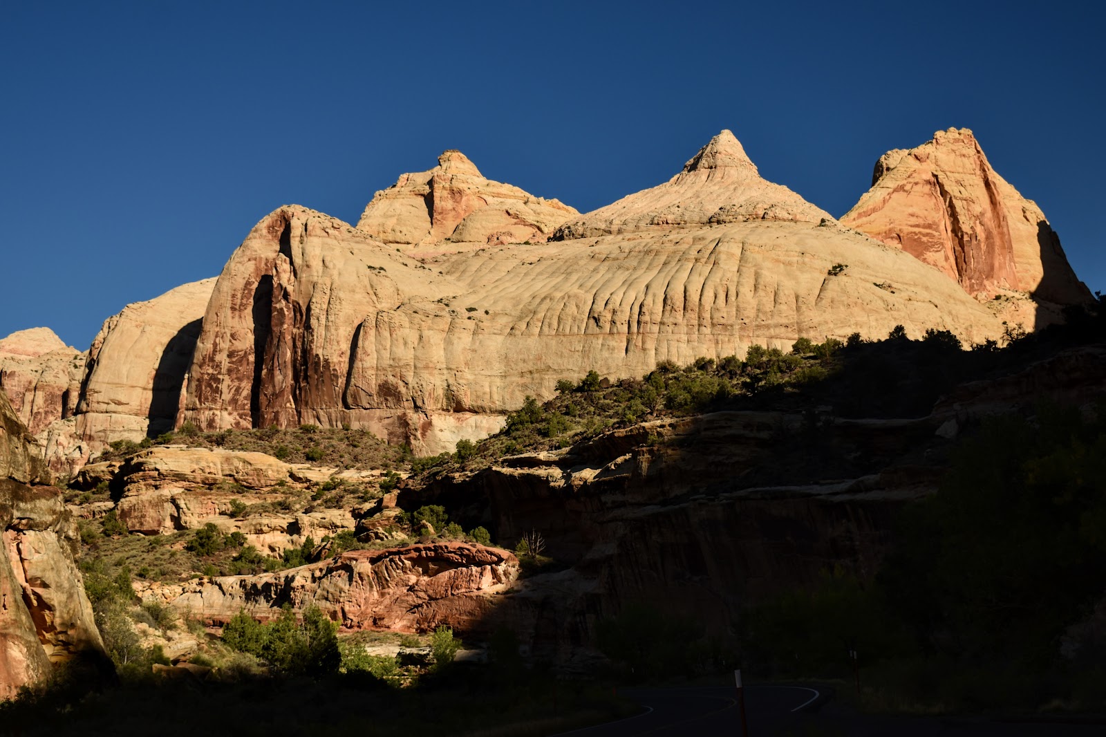
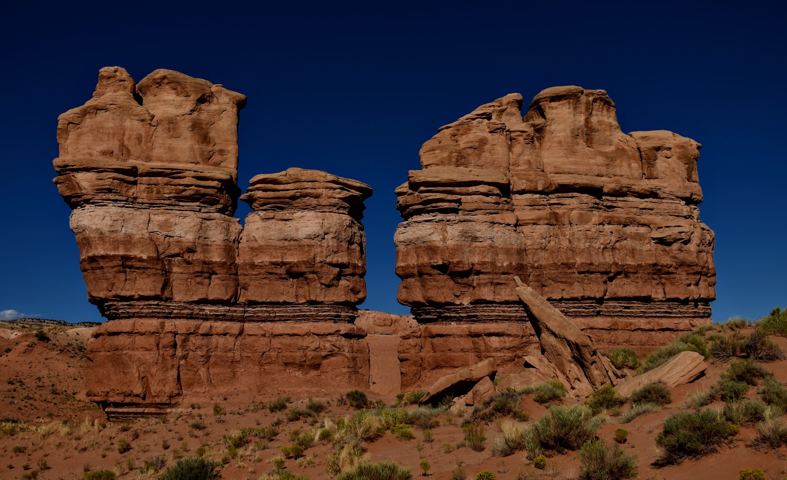
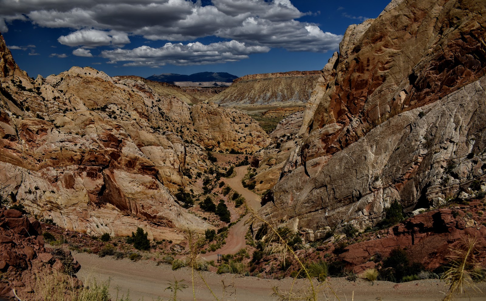
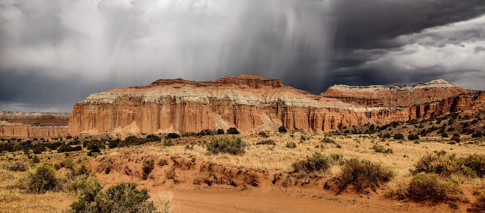
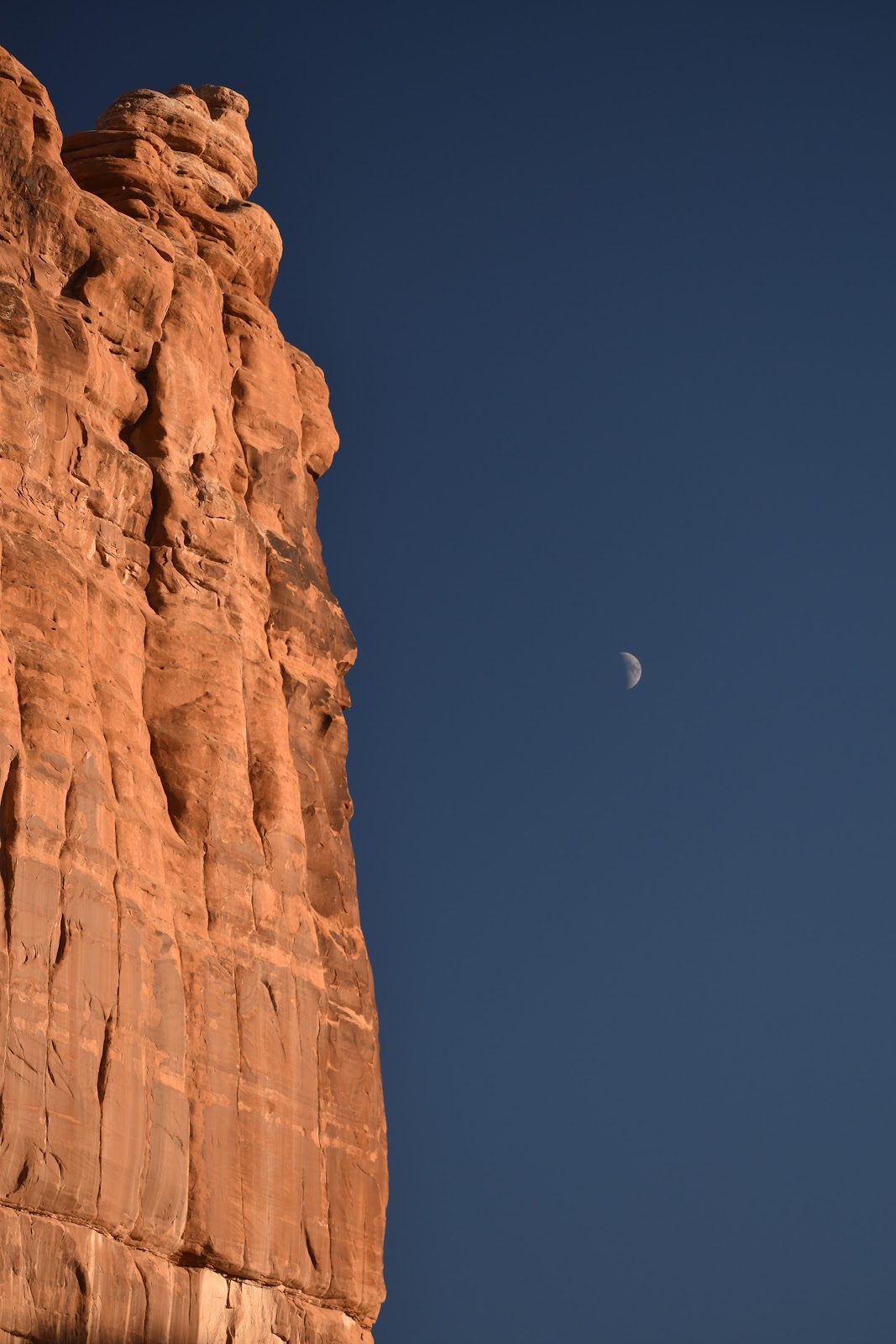
More pics of spectacular rock formations …
The rounded white rock formation just right of center is the namesake for this national park. They thought it looked like the capitol in Washington, DC.
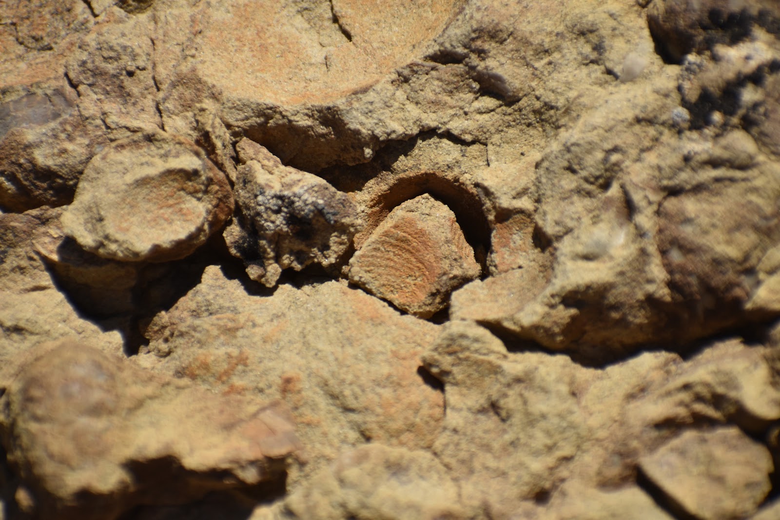
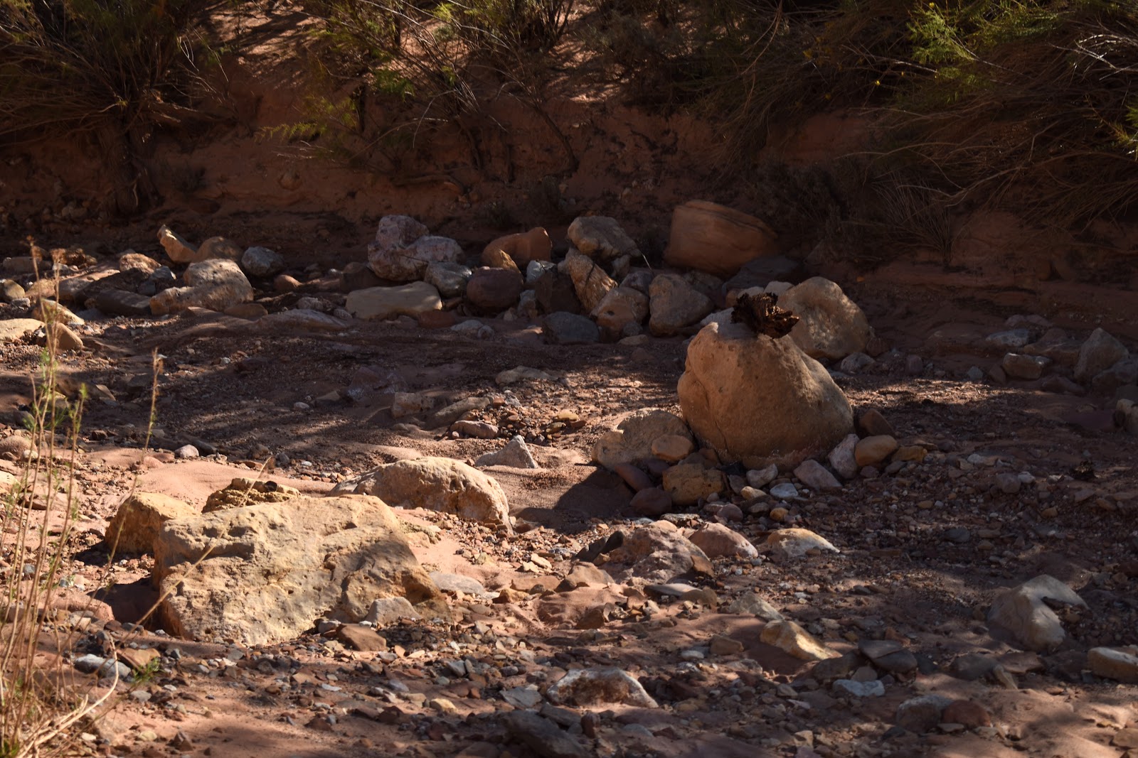
Fossils
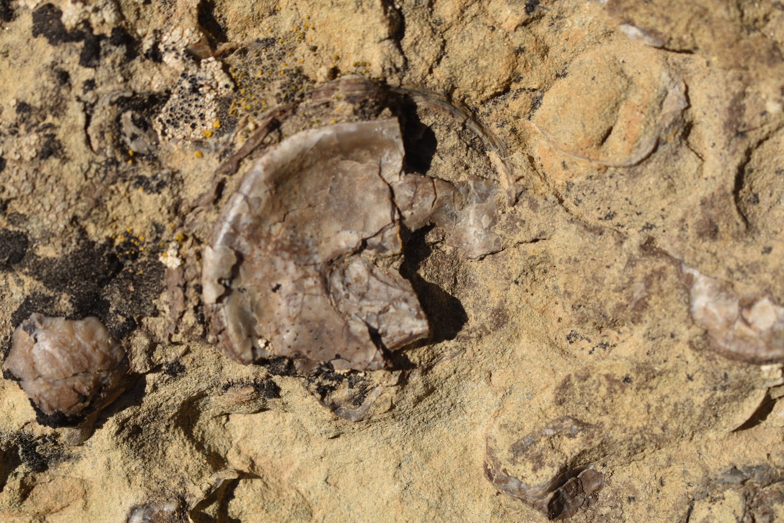
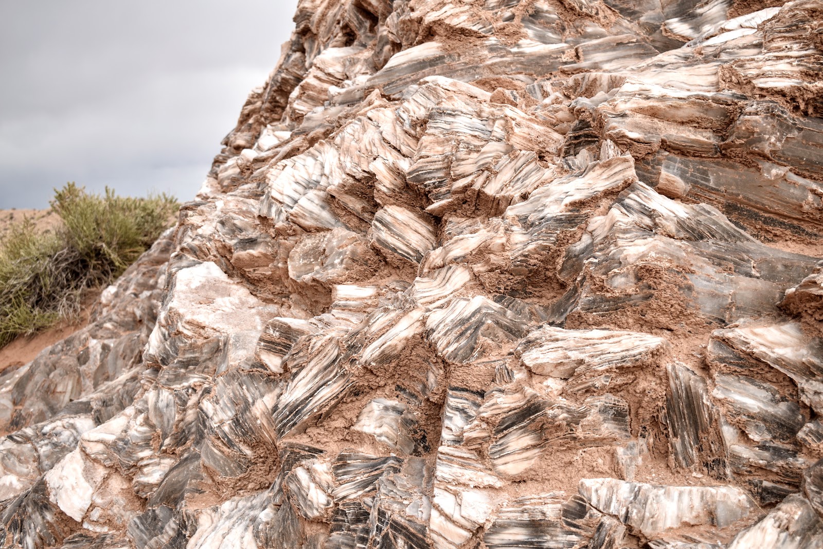
The shape of the shell fossils in the sandstone.
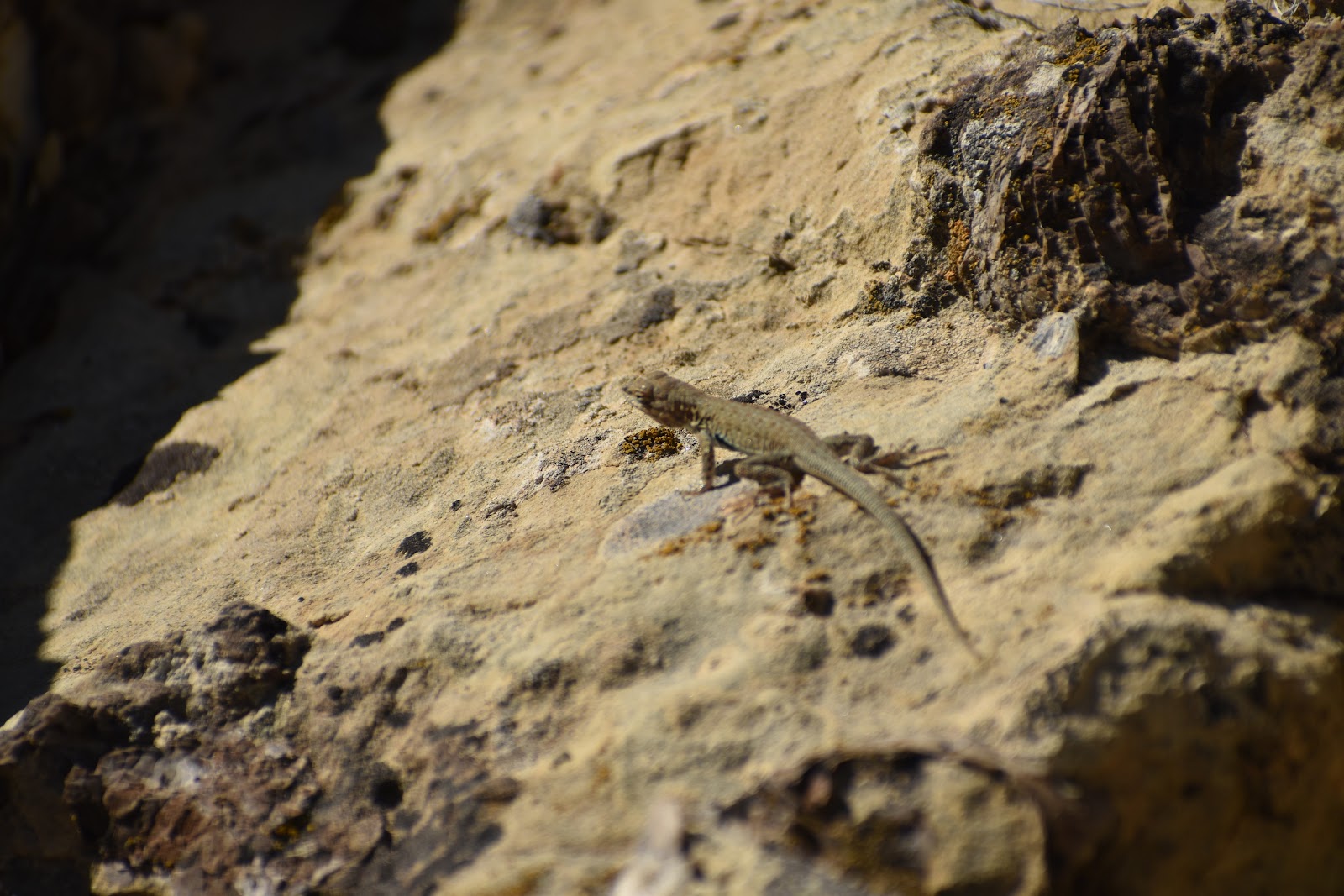
fossils and a lizard
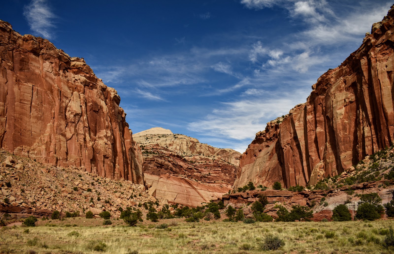
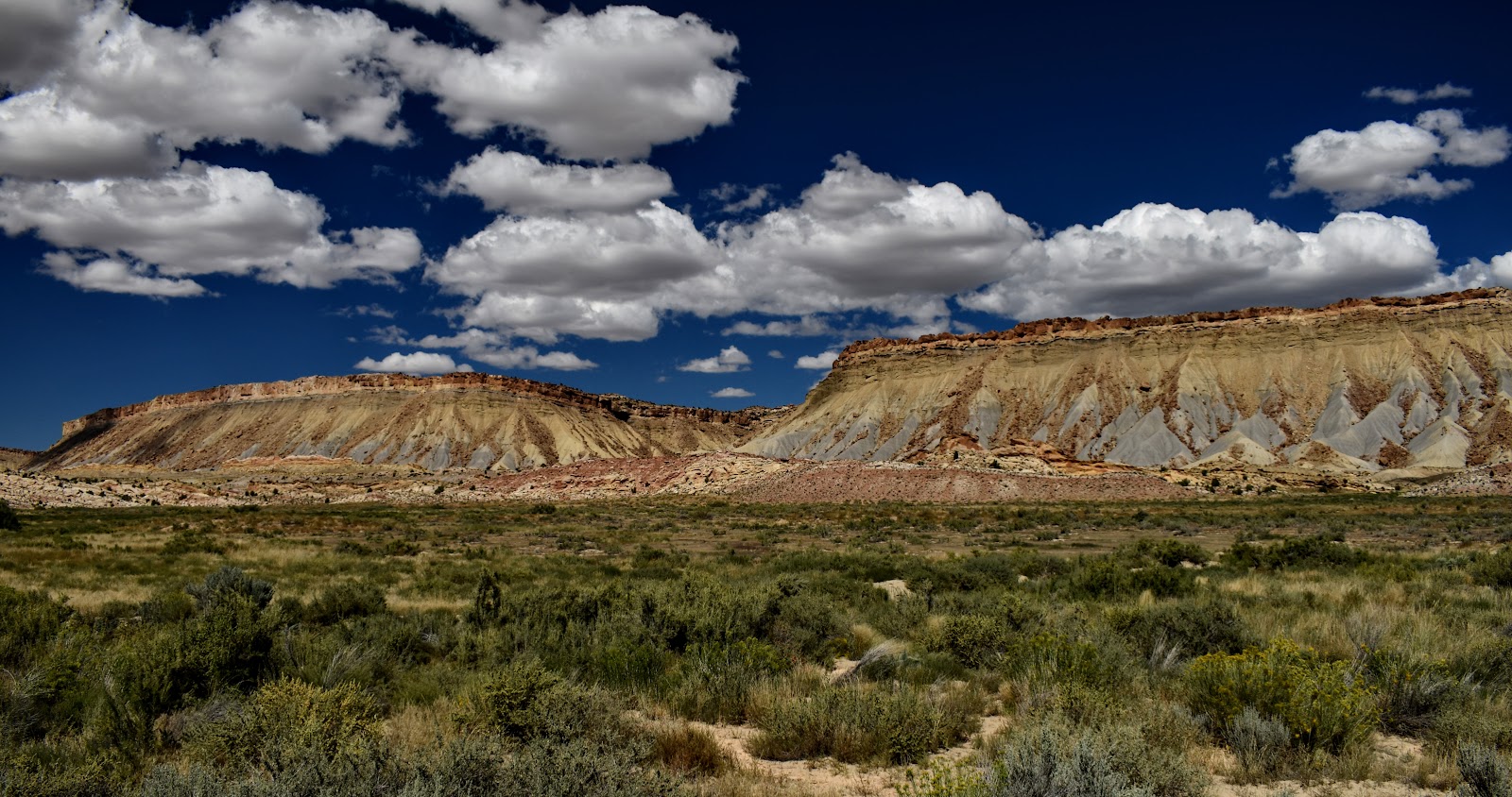
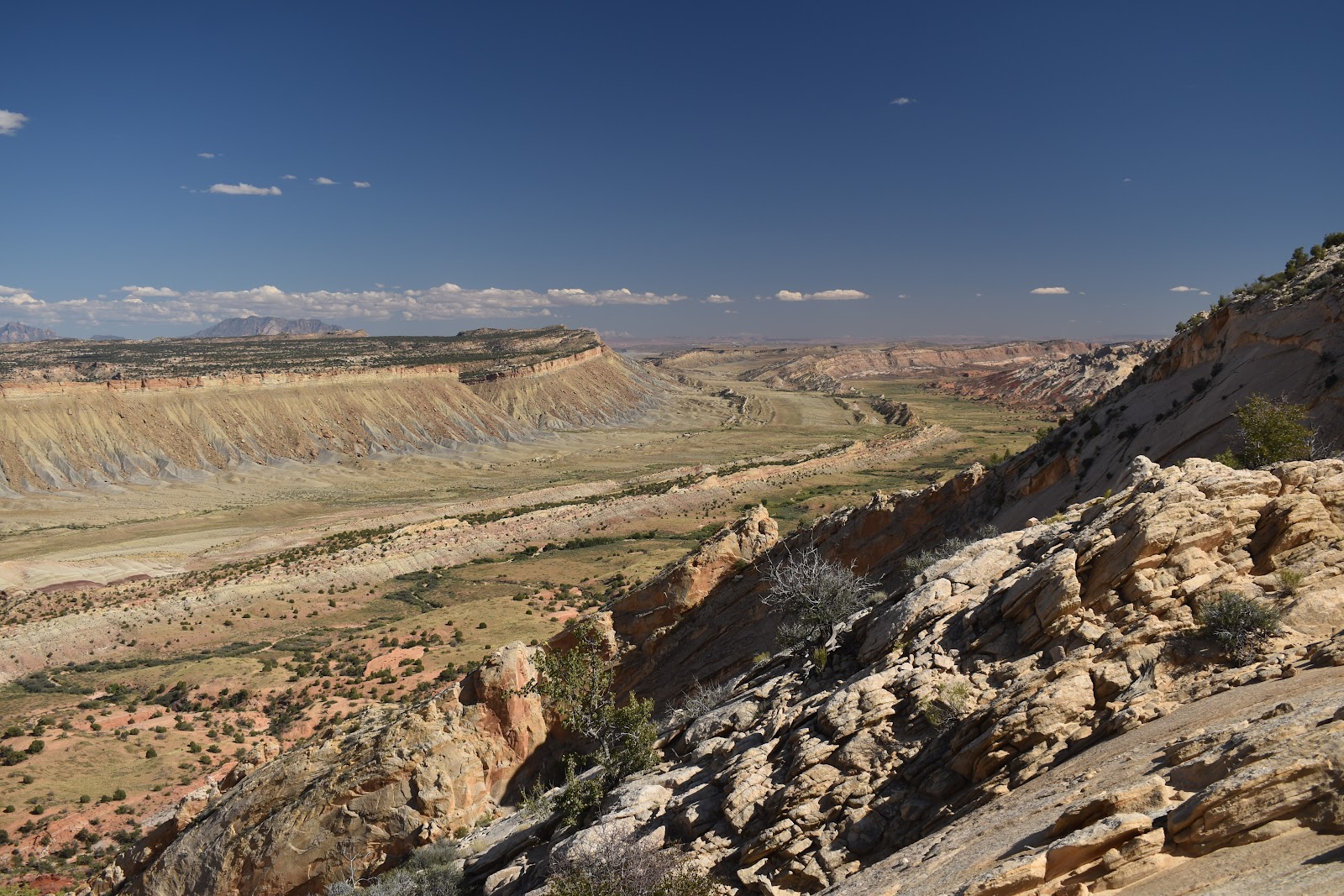
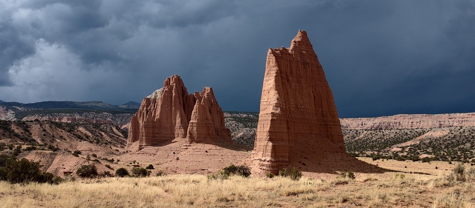
Some pics close to the fold.
And this is one of the clearest pics of the waterpocket fold. We hiked out on a trail so we could really see the geology.
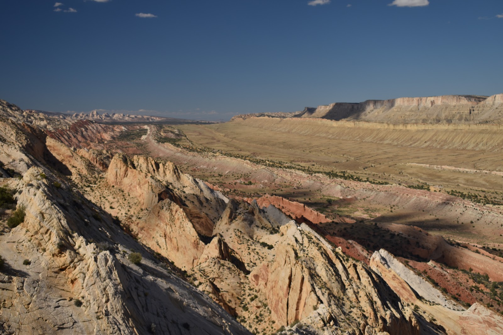
And the waterpocket fold in the other direction.
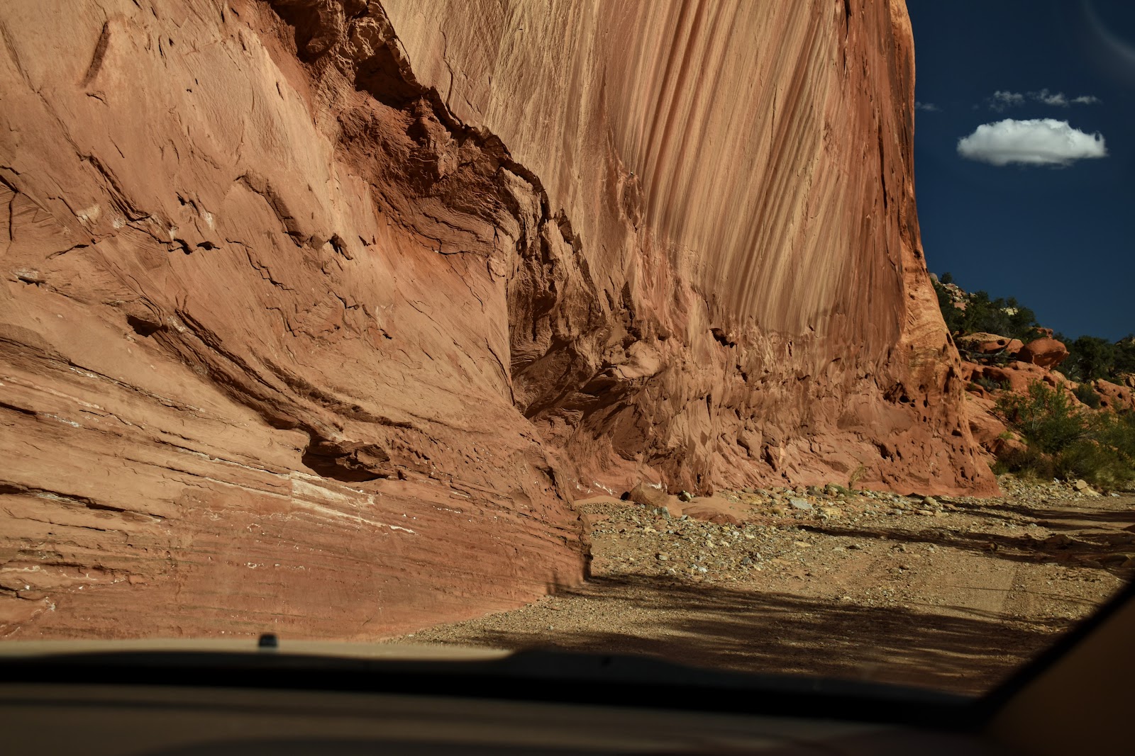
We tried our hand at some off road wheeling…we actually went on two different “roads”. (Ok, truth, Martin drove, of course, and I tried to help him avoid the biggest rocks while trying to keep my back in alignment)
The next few pics are of the first trip …
Now I ask you, does that look like a road???
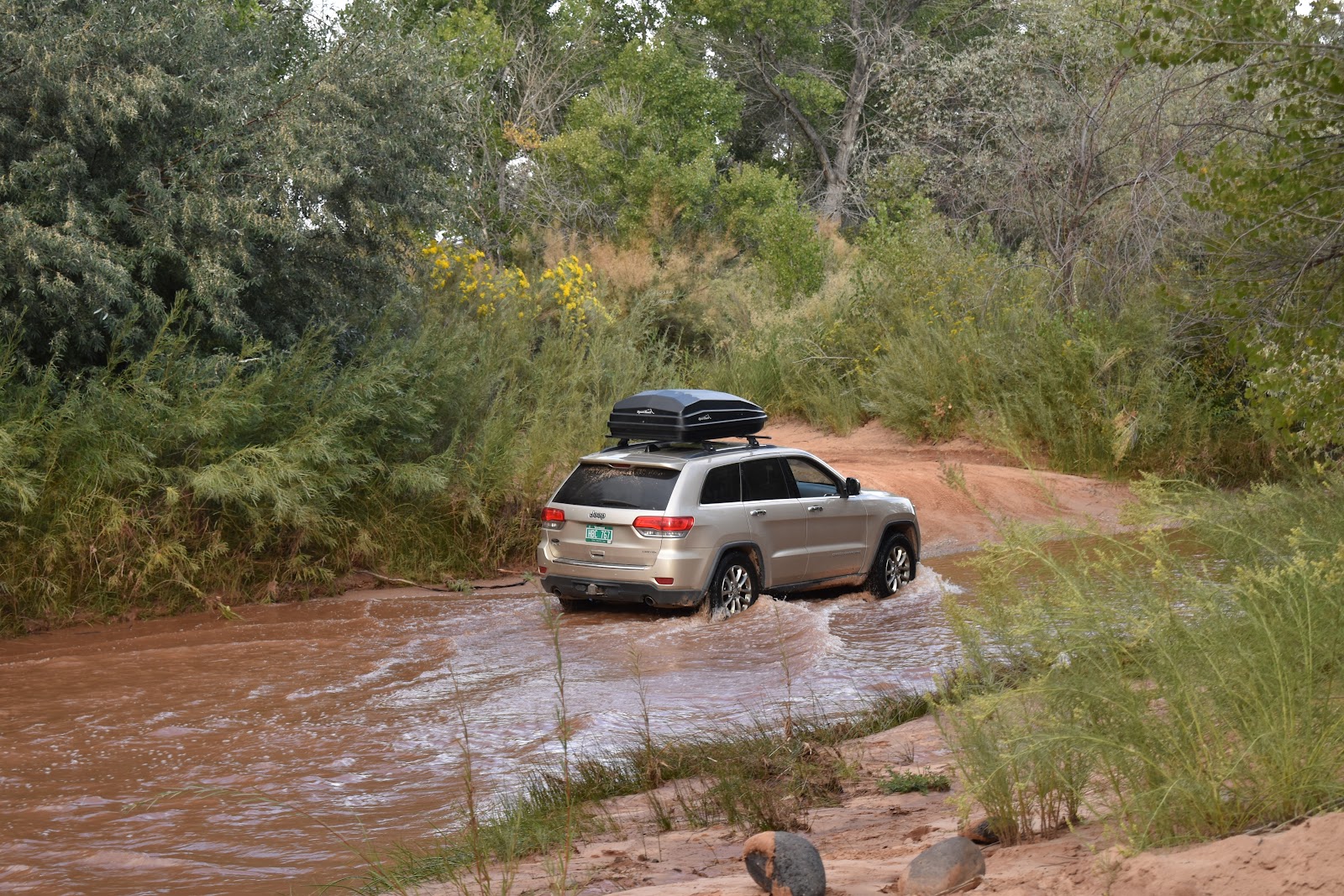
Our second trip required a river crossing! 😱
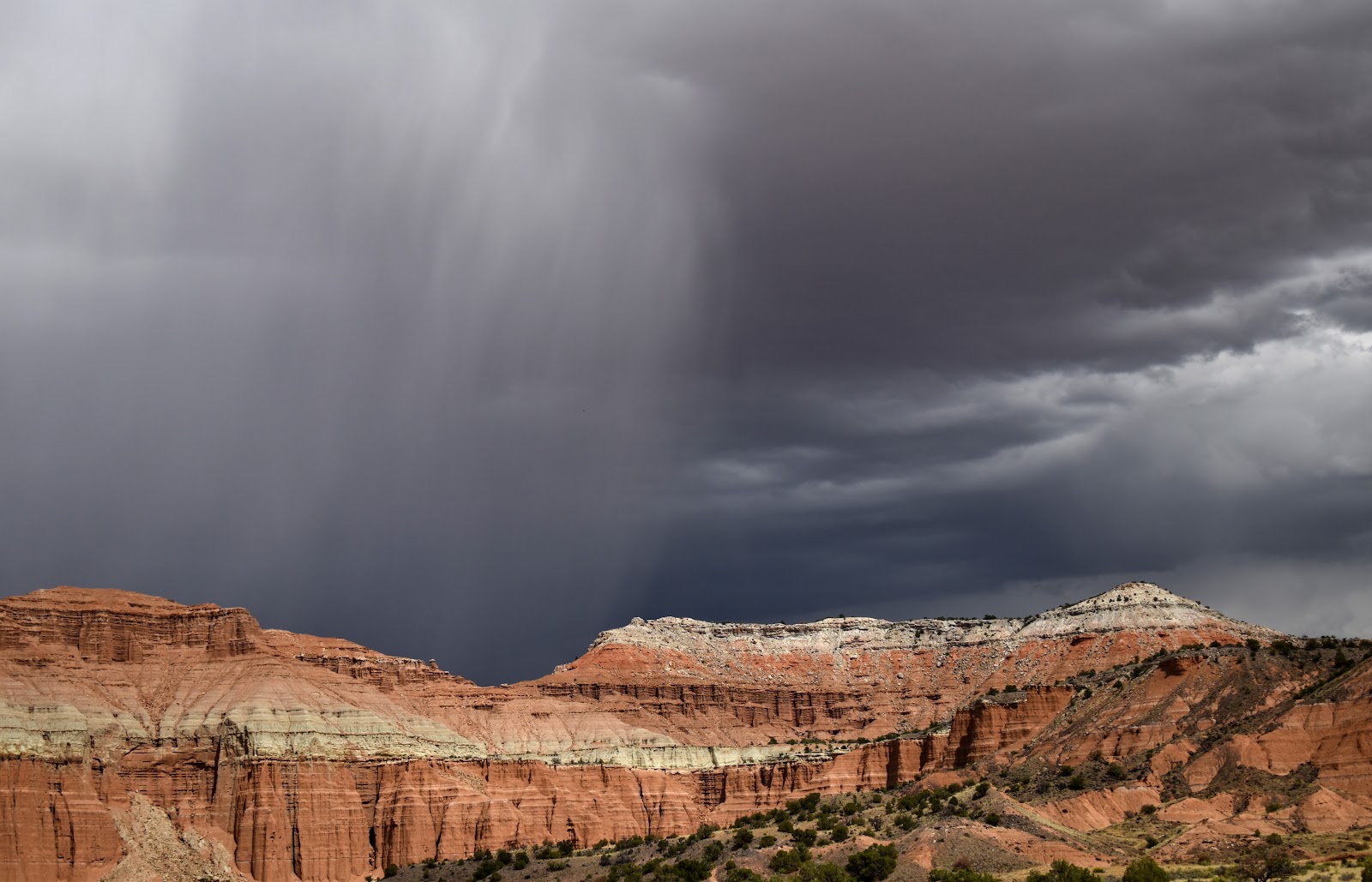
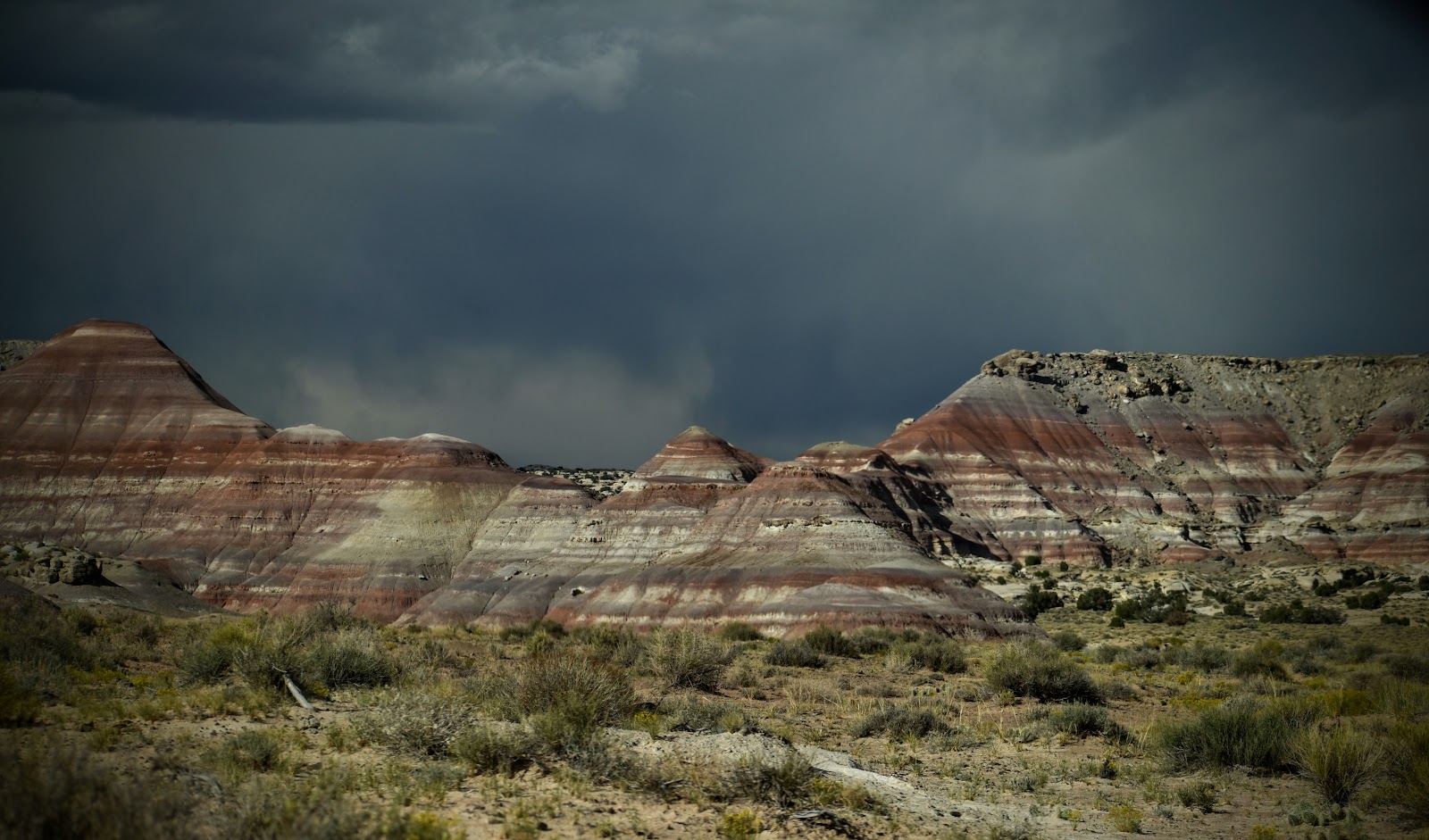
Another storm. Not hard to see the rain line.
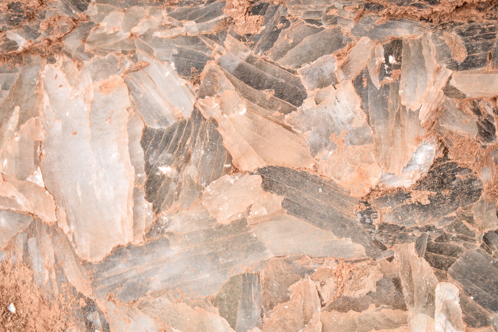
Glass mountain
Glass mountain is made of selenite crystals (gypsum). (Note: that's what the white sands of White Sands NP are made of.)
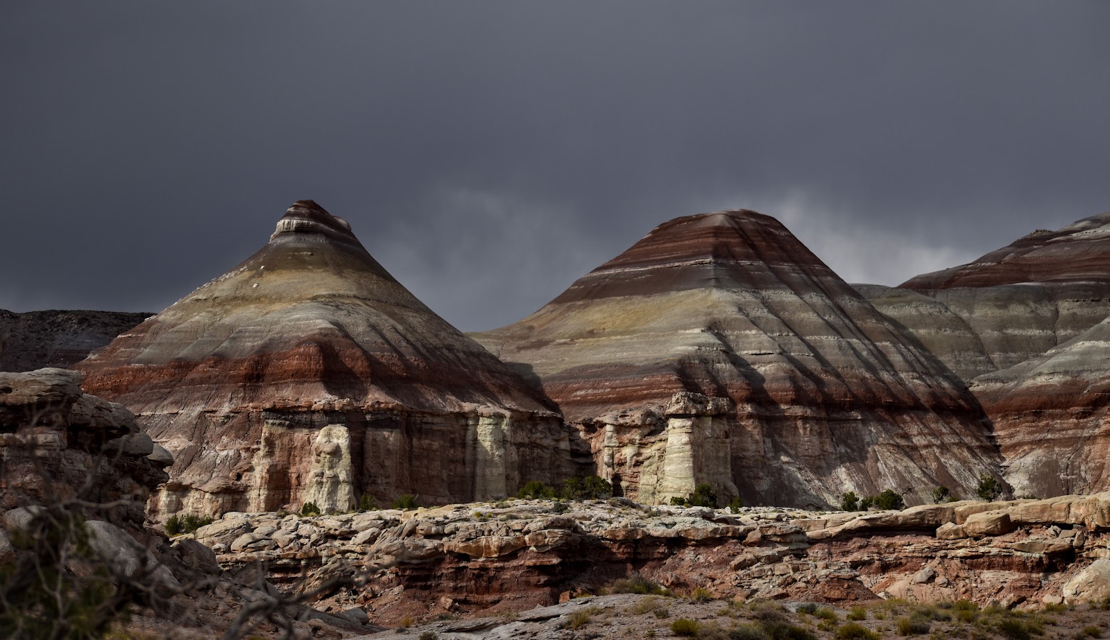
And just when you think you've seen all this park has to show in terms of geology … you come across these gorgeously banded hillsides set against spectacularly ominous skies.
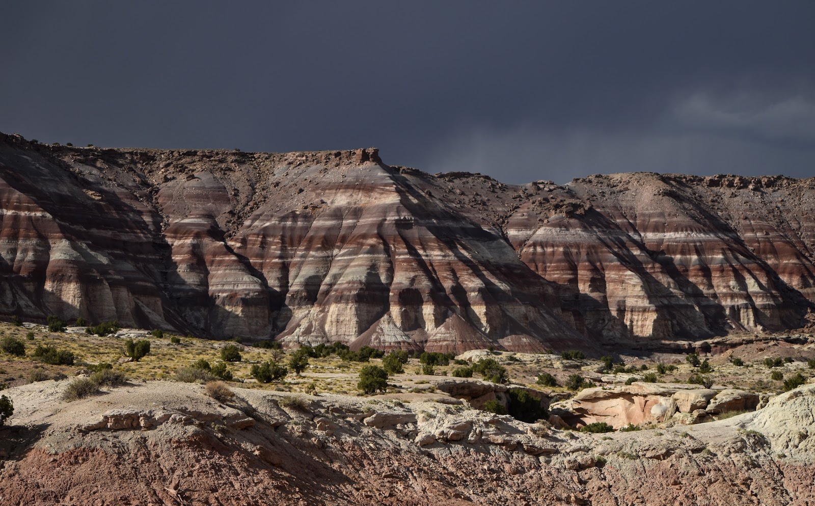
And then, of course, the sun would shine again.
This was one of my favorite vistas in the park.
Next stop: Arches National Park with a quick stop at Goblin State Park, Utah on the way.


Comments
Post a Comment